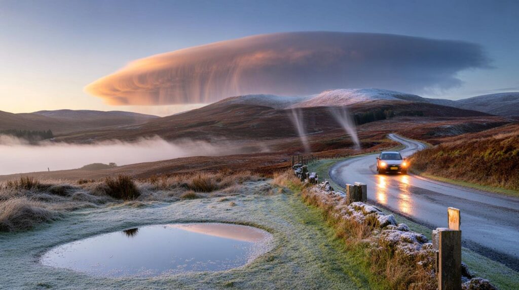
A sharp shift in the weather is looming, nudging thermostats, travel plans and wardrobes as summer routines quickly fade.
Britain is braced for the season’s first hints of wintry weather, with model charts flagging a risk of flurries on Sunday. The focus sits over central Scotland, where higher ground stands a better chance of seeing a brief dusting. Temperatures are set to dip close to 0C at dawn in a few spots, with chilly nights and crisp mornings likely elsewhere.
What the maps and models are signalling
A pronounced bend in the jet stream is steering a colder airmass south towards the UK. That kink drags in air of polar origin, undercutting lingering late‑summer mildness. Third‑party weather charts used by forecasters highlight narrow bands of precipitation turning wintry over the hills of central Scotland on Sunday, with rain or sleet lower down.
Early flakes look most likely in the Central Belt’s uplands on Sunday, particularly around Stirling, Falkirk and Clackmannanshire.
Signals extend, weakly, to some neighbouring uplands. The Grampians, the Trossachs and high routes through Perthshire could see passing flurries if the colder pocket times with showers. Any settling looks unlikely outside the highest ground and would be fleeting.
Where and when the flakes could fall
Timing matters. The colder air arrives as showers pivot through on Sunday, making short, local bursts more plausible than a widespread event. Based on current guidance, these locations carry the higher risk:
- Stirling and the Trossachs: brief hill flurries during Sunday morning and midday.
- Falkirk district: wet snow or sleet on the highest points if showers intensify.
- Clackmannanshire and Ochil Hills: passing snow showers over tops, rain or sleet below.
- Perth and Kinross uplands: a few flakes in heavier bursts, mainly above 300–400 metres.
- Western Grampians: isolated wintry showers on peaks, more often rain at lower levels.
| Region | Time window (Sun) | Snow risk | Overnight low | Notes |
|---|---|---|---|---|
| Stirling | 06:00–14:00 | Hill flurries | Near 0C in rural spots | Mostly wet roads; slick on high routes |
| Falkirk | 08:00–12:00 | Sleet/snow on tops | 1–3C | Transient; turns to rain below 300 m |
| Clackmannanshire | 07:00–13:00 | Brief flakes | 0–2C | Ochil Hills most exposed |
| Perthshire uplands | Morning | Isolated | 0–2C (rural) | Short‑lived; limited impact |
Why the pattern is flipping
The jet stream, a ribbon of fast air high above the Atlantic, often decides our week. A “kink” or trough to the west of the British Isles digs south, allowing cooler air to slide in underneath. That pattern also injects energy into passing weather systems, which is why you’ll see a mix of showers, some brisk winds and brighter spells rather than a steady, settled picture.
Computer models agree on the cooler interlude. They diverge on how quickly high pressure can reassert itself from the west later next week. That detail determines whether chilly nights linger or milder south‑westerlies return sooner.
How cold will it feel?
Air temperatures could dip to 0C in sheltered glens and rural pockets of Scotland at dawn on Sunday and early next week. Many towns stay a touch higher. A light breeze will add a bite on hills, especially during showers. By day, values recover to something closer to seasonal norms, but they’ll feel a world away from the recent warmth.
Expect sharp, radiative chills overnight where skies clear, leading to patchy grass frost and early mist in prone spots.
Travel, outdoor plans and your home
For most, this is a signal to shift gears rather than a cause for disruption. Even so, the first taste of wintriness often arrives when drivers and walkers least expect it. A few practical steps help:
- Motorists: check tyre pressures, screen‑wash and wipers; allow extra time over high routes on Sunday morning.
- Commuters: prepare for a colder platform and possible brief, sharp showers between sunnier spells.
- Hillwalkers: pack a warm layer and gloves; wind and visibility can flip quickly in showers.
- At home: bleed radiators, test the boiler, and lag exposed pipes in draughty spaces.
- Gardeners: move tender pots under cover; a touch of grass frost is possible after clear nights.
What the official outlook says
Met Office guidance into late September keeps the theme mixed. Further pulses of rain and some windy intervals look likely at times, punctuated by brighter, showery interludes. A ridge of high pressure could build from the west during the following week, favouring longer dry spells first in the north. If that ridge settles overhead for a time, nights turn chilly with fog patches forming before sunny, cool days.
Into early October, confidence in a dominant pattern drops. A familiar autumnal mix appears on the cards: northwest districts more prone to wet and windy spells, the southeast seeing longer drier breaks. Temperatures oscillate around the seasonal average.
Key takeaways for the next 10–14 days
- Sunday: risk of hill flurries in central Scotland; chilly start widely in the north.
- Next week: a cooler phase with clear nights, patchy fog and bright days for many.
- Late next week: rising chance of drier periods under a ridge, especially further north.
- Early October: mixed signals, with the northwest likely more changeable than the southeast.
What counts as the “first snow” of autumn?
Forecasters often use “first snow” to describe the first visible flakes of the season, even if they melt on contact. The UK can see such flurries on high ground in September during a northerly snap. Substantial, low‑level snowfall usually waits until later in the year when colder air persists and ground temperatures fall.
Why a flurry matters even if nothing settles
A brief burst tells you the pattern has flipped. It flags colder sources of air feeding in, which encourages sharper overnight drops, mist‑forming nights and an uptick in wind‑chill on the hills. It also acts as a reminder to finish seasonal jobs—clearing gutters, checking roof tiles and scheduling a boiler service—before true winter weather beds in.
Looking ahead: small choices that make a big difference
Use the cooler interlude to run a short “winter drill” at home. Test smoke and carbon‑monoxide alarms, top up car antifreeze, and keep a compact torch with fresh batteries near the door. If you commute early, set out gloves and a hat the night before. These small habits reduce stress when dawns turn darker and colder.
For those planning autumn hikes, map an escape route that drops quickly off the ridge if showers pile in. Share your plan, carry a charged phone and a spare layer, and time summits earlier in the day while cloud bases sit higher. The season is changing; a little forethought keeps the adventure enjoyable.


Models say flakes over the Ochils, but won’t this just be sleet that melts on contact? Feels a bit like hype—definately not “first snow” if nothing settles, right?
First flakes already? Love a crisp morning—packing gloves for a Stirling hike Sunday. Thanks for the clear timings! 🙂