Skies turn steel grey, winds back north-west, and road frost creeps in as Britain’s weather mood swings sharply.
Forecast charts now paint a brisk plunge into wintry territory, with air cold enough for snow in places you drive, work and walk.
What the latest models show
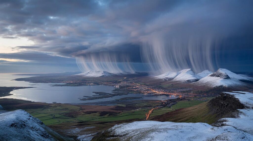
High-resolution maps from WX Charts, using MetDesk data, point to a 24-hour spell of wintry precipitation before the month ends. Guidance based on the GFS model flags a notable window around 27 October, with showers turning to snow across Scotland first, then clipping parts of Northern Ireland, Wales and northern England as the air mass cools.
The signal is strongest for central and northern Scotland, the Highlands and Cairngorm foothills. The North East of England sits next in line, with the Pennines and Cheviots picking up the most frequent bursts. Northern and central Wales show a lower, but credible, chance. Northern Ireland could see temporary coverings over higher routes, especially late evening and overnight.
Model output suggests snow rates near 1cm an hour at first, rising locally to around 2cm an hour in Scottish uplands as colder air deepens.
As skies clear between showers, temperatures may slip to around -1C in sheltered Highland glens, with low single figures widely elsewhere. Road surface temperatures lag the air by a fraction, so ice risk grows fast after sunset.
Who is most likely to see settling snow
- High ground above 200–300m in Scotland: frequent snow showers, temporary drifting in gusts.
- Pennines and Northumberland uplands: snow showers mixed with hail; slushy coverings possible overnight.
- North and central Wales hills: wet snow likely above 300–400m late evening.
- Northern Ireland’s Sperrins and Antrim Plateau: brief accumulations over higher roads.
- Coasts and lowland cities: sleet or wet snow in heavier bursts, but marginal for settling.
The Met Office line
The broader setup stays unsettled with low pressure running in from the west and south-west, throwing bands of rain and showers across the country. Winds pick up at times, especially around frontal waves. Through the back end of October, guidance leans toward a cooler, more showery north-westerly, as high pressure nudges in over the Atlantic while lower pressure drifts to our east. That pattern often feeds convective showers off the ocean into exposed coasts and hills. As November opens, a changeable mix remains likely, with the west catching the wettest conditions. Southern counties could see a drier pause at times, which increases the risk of overnight fog where winds ease.
Small shifts in the track of each low will decide whether your postcode sits under cold enough air for snow or stays in cold rain.
Travel, power and daily life
Shower lines arrive fast and fade just as quickly, which catches drivers off guard. Expect variable conditions over short distances. The first wintry episode of the season also tends to expose weak spots in tyres, wipers and batteries.
- Roads: watch for black ice on untreated routes, bridges and shaded bends after dusk.
- Rail: points and overhead lines dislike sharp hail and wet snow; minor delays are possible on exposed corridors.
- Airports: brief ground-halt procedures are possible in Scotland and Northern Ireland during heavy bursts.
- Power: gusty squalls with hail can trip lines; keep a torch and phone power bank handy.
- Health: cold, damp air can aggravate asthma; carry reliever inhalers and check forecasts before outdoor exercise.
Schools and events
Local authorities in the Highlands, the North East and upland Wales may grit priority routes overnight if rates look high. Morning school runs over higher passes could take longer. Outdoor sport faces slippery surfaces; organisers should plan early pitch inspections and have alternatives ready.
How much and where: at a glance
| Region | Likely 24-hour window | Peak snow rate | Night-time low |
|---|---|---|---|
| Highland and central Scotland | 27 Oct evening to 28 Oct evening | Up to 2cm/hour on hills | Near -1C in sheltered glens |
| North East England and Pennines | Late 27 Oct into early 28 Oct | Around 1cm/hour in heavier showers | 0–2C widely |
| North and central Wales | Overnight 27–28 Oct | Up to 1cm/hour above 300–400m | 1–3C |
| Northern Ireland | Late 27 Oct night | Briefly 1cm/hour on high routes | 1–3C |
Why the pattern could flip quickly
This setup relies on maritime polar air spilling in behind passing fronts. Over relatively warm seas, showers grow tall and pepper the north-west, then stream inland on the wind. If a low tracks 100 miles further north, many inland areas sit on the milder side and see cold rain instead. If the low slides south, colder air bites, and more places see wet snow to low levels at night. That knife-edge explains the sharp differences between model runs you might see on social media.
Over the Irish Sea and North Sea, sea-effect snow bands can form if winds align. These narrow corridors deliver sudden, intense bursts with large local contrasts. Move ten miles and conditions look very different. Keep an eye on radar on the day, as that shows the real bands in motion.
What to watch over the next 72 hours
- 00z and 12z model runs: look for consistency on the wind direction and thickness lines over northern Britain.
- Dew points: if they drop near or below freezing, snow survives farther down the slopes.
- Wet-bulb values: brief heavy bursts can cool the air column enough for snow even when the screen says 2–3C.
- Ground temperature: newly chilled surfaces increase the chance of slush sticking on minor roads.
Practical steps before the first wintry day
Top up washer fluid, check tyre tread, and keep a winter kit in the boot: scraper, de-icer, blanket, snacks and a small shovel. If you work flexibly, consider shifting commutes away from the worst window. Charge devices in case of brief outages and note a backup heat source if you have one. Dog walkers and runners should switch to high-visibility layers and grippier footwear for early mornings.
Extra context for the keen weather watcher
Upland routes accumulate fastest because showers squeeze out moisture as air climbs the hills. That orographic lift boosts rates to the 1–2cm an hour flagged by model guidance. On valley floors, intensity matters more than the thermometer reading; a squall can flip rain to wet snow for 10–20 minutes, then melt soon after. Don’t mix “snowfall” with “snow on the ground”: one measures what falls, the other what sticks.
If you plan a hill day, carry microspikes and a spare layer, plot bail-out routes below the ridge line, and check local avalanche notes once early-season snow begins to bridge gullies. Coastal anglers and surfers should factor in squally crosswinds and short, choppy seas during the colder northwest flow.


Bring it on – sledges ready!
Heard this before – models flip 100 miles and its cold rain. I’ll believe the 2cm/hr when the radar lights up. Still, -1C in glens sounds legit.