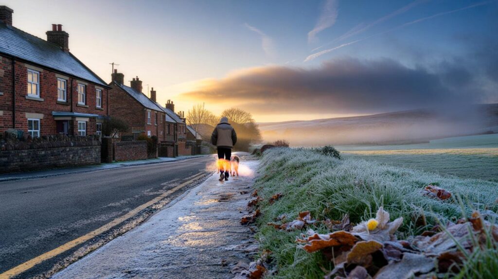
Misty dawns, dazzling blue skies and a bite on the breeze are lining up as the season tilts decisively colder.
A calm, bright spell is about to give way to something harsher, with model guidance pointing to 0C in parts of the north and single-digit days almost everywhere. Brief hill snow, overnight frost and some soaking showers could arrive close behind.
How the cold sets in
High pressure remains the main player until the third week of the month. That pattern favours light winds, clearer skies and long October nights. Heat escapes skyward after sunset, so temperatures sink quickly. Expect pockets of fog at dawn, then cool sunshine for many.
From around 21 October, charts driven by MetDesk data and plotted by WX Charts suggest a northerly feed nudging into Britain. That opens the door to much colder air and a widespread drop in temperatures, with the sharpest chill in upland and northern areas.
Weather models flag 0C in parts of northern Britain around dawn on 21–22 October, while daytime values hold in the mid to high single digits for many.
Timeline: 21–22 October at a glance
- By early 21 October, sub-zero spots likely in sheltered northern glens and dales.
- Overnight into 22 October, frost pockets push farther south into the Midlands and Wales.
- Showers track from the south-west towards north-eastern coasts; some turn wintry on the highest Scottish ground.
- Daytime temperatures struggle: 6–9C widely, 3–5C on northern hills in any breeze.
Who feels it most
Not everyone gets the same flavour of cold. Northern hills lose heat fastest, and sea-facing coasts feel raw where showers come ashore. Here’s a region-by-region steer based on current signals.
| Region | Night lows 21–22 Oct (°C) | Daytime highs (°C) | Precipitation risk | Notes |
|---|---|---|---|---|
| Scottish Highlands | -2 to 1 | 3–6 | Showers, hill snow flurries | Brief, slushy coverings above 400–500 m possible near midnight on 22 Oct |
| Central Scotland | -1 to 2 | 5–7 | Scattered showers | Wintry specks on the highest tops; little, if any, lasting snow |
| Northern Ireland | 0 to 3 | 6–8 | Light rain at times | Clear spells bring frost in rural spots |
| Northern England | 0 to 3 | 6–8 | Showers east coasts | Chill accentuated on the North York Moors and Pennines |
| Wales | 1 to 4 | 7–9 | Patchy rain west | Frost hollows in mid-Wales; brighter in the east |
| Midlands | 1 to 4 | 7–9 | Intermittent light rain | Fog likely at dawn, clearing slowly |
| South West | 3 to 6 | 8–11 | Bands of rain | Breezier along exposed coasts |
| South East & East Anglia | 2 to 5 | 8–10 | Mostly dry | Cold, bright days; chilly nights where skies clear |
Rain, wind and a dash of hill snow
Before the colder air bites, a couple of weak fronts brush the far north with drizzle and stronger breezes. Later, as the wind tilts more northerly, showers run in off the North Sea and Irish Sea. Western areas from Cornwall through Wales to the north-west Midlands pick up the most rain, with a few millimetres possible in bursts.
Central Scottish uplands look cold enough for a short spell of wet snow late on 21 into 22 October. Current guidance limits any accumulation to around a millimetre or so, and it should melt quickly once showers ease or the sun reappears.
Short-lived flakes over central Scottish high ground remain possible, but models keep totals tiny and the window brief.
Travel and daily life: what to expect
- Morning commutes: fog and a touch of frost may slow rural routes; allow extra braking distance.
- Rail: leaf-fall season reduces adhesion; expect cautious driving on the rails and minor delays in the mornings.
- Roads: first frosts bring greasy surfaces; check tyre pressures and screen wash rated to at least -5C.
- Homes: insulate outdoor taps, bleed radiators, and set heating timers to pre‑warm before waking.
- Health: cold, damp air can aggravate asthma; pack inhalers and layer up, especially for early starts.
- Pets and livestock: provide dry shelter and fresh water; ice can form in metal bowls overnight.
Why this pattern now
October often flips between quiet high-pressure spells and brisk Atlantic phases. This time, a blocking high steadies the weather first. As it slips or shifts, cooler air slides south from higher latitudes. The contrast between lingering warmth at the surface and much colder air aloft sparks showers, especially where wind meets hills or warmer seas.
Because nights are long, radiative cooling does the heavy lifting. Valleys trap cold air and spring the earliest frosts. Urban centres stay a touch milder thanks to retained heat from buildings and roads.
What the models say next
Longer-range guidance favours a more unsettled picture from around 21 October into early November. Many places could see bands of rain or showers at times, with blustery spells later in the month. Between fronts, clearer, colder nights return and frost remains a risk.
Expect a to‑and‑fro: wet, breezy interludes split by crisp, chilly nights with localised frost and morning fog.
Confidence and caveats
Pinning down the exact frost line at five to ten days is tricky. Small shifts in wind direction or cloud can add or remove a degree. Treat city forecasts as milder than nearby countryside. Hill snow looks marginal and fleeting in the current setup, but modest changes in air depth or timing could shuffle the freezing level by a couple of hundred metres.
Extra context to help you plan
Ground frost and air frost differ. Ground frost refers to freezing at the surface, which can occur even when thermometers 1.25 metres above ground show 1–2C. Air frost means the standard screen temperature falls to 0C or below. Gardeners care about the former, motorists about both.
Wind chill does not lower the thermometer, but it increases heat loss from skin. A breezy 6C can feel closer to 2–3C if you stand exposed. Gloves and a hat reduce heat loss noticeably on early school runs or pitch‑side weekends.
If you want a quick home check before the first proper frost, run a simple “draught audit”: on a still evening, hold a lit incense stick near letterboxes, keyholes, and skirting boards. Smoke that drifts or flickers marks leaks. Seal small gaps with adhesive foam or putty, then close heavy curtains after dusk to trap warmth overnight.
Sports clubs and event organisers should plan for harder ground and lower visibility at first light. Consider later kick‑offs, grit supplies for car parks, and a fog protocol for junior sessions. Farmers may want to shift watering routines to mid‑afternoon to reduce overnight icing in troughs.


Clear piece on radiative cooling. Given the urban heat island, do you expect central London to stay above 2–3C while suburbs dip to 0C? Asking to plan my cycle commute and whether to watch for black ice.
Time to dust off the big coat and the emergency teabags—sleet incoming! 😅 Does this mean crunchy lawns by sunrise in the Midlands, or just foggy windows and soggy socks?