Frost flecked lawns and breathy commutes start the week, but a swift flip in the skies now edges closer.
Cold air poured in from the north over the weekend, even dropping a few flakes in places. Now forecasters flag a very different setup, with milder air likely to push in from the south-west as the week progresses.
From Arctic chill to Atlantic push
After the weekend’s nip, the UK sits in a northerly flow that keeps mornings sharp and afternoons cool. Forecast models then swing the pattern. By late week, Atlantic air rides in, softening temperatures and lifting daytime highs for many.
A milder south-westerly looks set to arrive by Friday, nudging temperatures towards 15C in the south-east.
This change won’t feel dramatic in one go. Expect a day-by-day recovery through midweek. By the weekend, the air mass flips from Arctic to Atlantic, and that swap brings a different set of trade-offs: less bite in the air, more moisture on the move.
What changes between Tuesday and Friday
- Early mornings stay cold in the north and rural spots, with grass frost and patchy fog.
- Afternoons recover to the low-to-mid teens in England and Wales by Thursday.
- Friday signals the milder peak for many, especially the south and east.
Temperatures: where and when you’ll feel the lift
The Met Office outlook indicates a steady climb. Parts of the south-east could reach about 15C on Friday and again on Saturday, with double digits widely elsewhere. By Sunday, highs of 10–13C look common across the UK, though the far north may sit a shade lower.
Sunday looks broadly milder than the recent cold snap, with many towns returning to 10–13C by afternoon.
| Region | Fri highs | Sat highs | Sun highs |
|---|---|---|---|
| South East | 14–15C | 14–15C | 11–13C |
| South West | 13–14C | 13–14C | 10–12C |
| London & East | 13–15C | 13–15C | 11–13C |
| Midlands | 12–14C | 12–14C | 10–12C |
| North West | 11–13C | 11–13C | 10–12C |
| North East | 10–12C | 10–12C | 9–12C |
| Wales | 12–14C | 12–14C | 10–12C |
| Northern Ireland | 11–13C | 11–13C | 10–12C |
| Scotland | 8–12C | 8–12C | 8–11C |
These are broad daytime ranges based on current guidance. Local peaks will vary with sunshine, elevation and wind direction, so check nearby forecasts for finer detail.
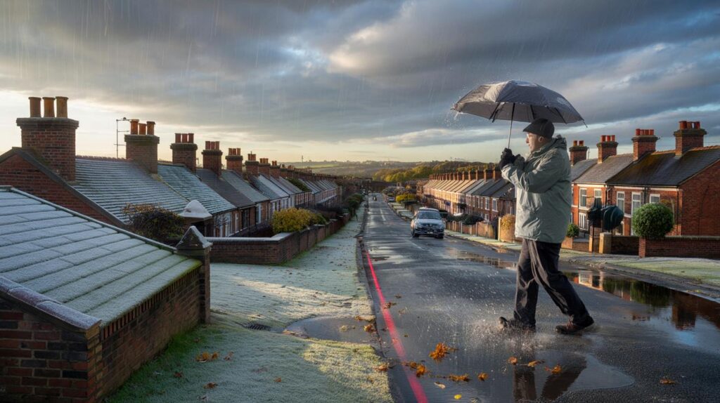
Rain bands, wind risks and who gets soaked
Low pressure looks keen to take charge from the end of the week into early November. That pattern typically drives pulses of rain across the country, with the wettest bursts tending to pile into western hills and coasts. Eastern counties may see drier gaps, but even there showers can break out as fronts sweep through.
Expect frequent spells of rain next week, strongest in the west, with occasional gusty winds and a chance of gales.
Between systems, short windows of sunshine can open up. Those pauses carry their own hazards: calm, clear nights allow fog to form and frost to nip back at dawn, especially in valleys and rural spots.
Halloween and Bonfire Night plans
For Friday (31 October), conditions trend milder, yet a front could topple in later, bringing showers or longer spells of rain. Costumes and face paint cope better with a light waterproof on top. For Saturday (1 November) and Sunday (2 November), many events go ahead in double-digit temperatures, but organisers should prepare for blustery intervals and slippery ground underfoot.
- Carry a compact brolly or hood; gusts can turn larger umbrellas into sails.
- Choose layers that breathe during mild spells and insulate when a breeze picks up.
- If travelling to displays, allow extra time for wet roads and low visibility in evening fog.
What’s steering the switch: the jet stream and air masses
The jet stream slumped south to deliver the weekend’s chill. As it kinks north and strengthens over the Atlantic, it opens the door to milder, moisture-laden air. Think of it as a conveyor belt: when the belt points our way, fronts arrive more often, and the weather flips from crisp and dry to milder but unsettled.
That Atlantic push rarely arrives quietly. Pressure gradients tighten, so wind increases near and behind fronts. Western upslopes squeeze more rain from passing clouds, which is why Cumbria, Snowdonia and Argyll often lead the totals when the pattern turns this way.
How to prepare this week
- Commuters: Cold starts linger midweek. Scrapers and de-icer still earn a place in the car.
- Runners and cyclists: Plan routes with wind direction in mind; a headwind home can drain energy fast.
- Parents: Waterproof layers for the school run and spare socks in bags for puddle days.
- Gardeners: Secure lightweight furniture before the weekend breezes, and lift pots to help drainage.
- Home energy: The temperature lift may trim heating use by a notch; smart thermostats can smooth the change.
Looking past the weekend
Into the first week of November, the broader signal points to a stop–start sequence of fronts, showers and short dry slots. Western areas stand the best chance of heavier, more frequent rain; the east picks up breaks but won’t stay immune. Winds rise at times with a risk of gales near coasts and hills. Temperatures sit near, or a touch above, the seasonal norm for early November.
Into early November, temperatures lean near to slightly above average, but the weather stays on the unsettled side.
In practical terms, “near average” means many lowland towns spending afternoons around 10–13C, with Scotland and high ground cooler. Nights drop lower where skies clear, keeping a low-end frost risk in sheltered spots. River catchments that saw a dry start to autumn may top up quickly under repeated fronts, so small streams could respond faster than usual after downpours.
If you track the day-to-day shifts, look for three flags: where the strongest winds align with the rain band, how quickly pressure recovers after each front, and whether fog becomes stubborn overnight. Those details decide whether you get a usable dry hour for jobs outside or another round of puddles on the pavements in time for the morning rush.


15C and rain? That’s British summer rebooted 🙂
Will the south-westerly arrive early enough on Friday for a dry school run in London, or should we expect showers by late afternoon?