Suncream and scarves may both earn space in your bag this week, as England toys with two seasons in days.
A late burst of warmth is lining up for parts of England, but it will be fleeting. Forecasters signal a sharp comedown by the weekend, with some rural spots set for a chilly 3C dawn and a spell of unsettled weather sweeping in from the Atlantic.
Where the warmth will land
After a summer stacked with heatwaves, a short window of September sunshine returns to eastern and south-eastern England. Weather models point to mid-week peaks at 23–25C, with the best chance of 25C on Wednesday 3 September, especially across the east of England and some Home Counties. Light winds and long sunny spells could make it feel warmer away from coasts, while sea breezes may trim the edge for beachgoers.
Up to 25C is most likely on Wednesday across parts of Norfolk and Suffolk, with 23–24C possible in several south-eastern counties.
Counties on 23–25C watch
- Norfolk
- Suffolk
- Cambridgeshire
- Lincolnshire
- Kent
- Greater London
- Surrey
- Berkshire
- Hertfordshire
- Buckinghamshire
- Bedfordshire
- Northamptonshire
- Leicestershire
- Rutland
- Nottinghamshire
- East Riding of Yorkshire
If you are inland and away from higher ground, you stand the best chance of a toasty afternoon. Coastal cloud may drift in at times, though gaps should bring bright periods.
How long the lull lasts
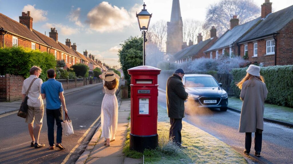
The warm spell looks brief. Expect a notable drop after 24–48 hours as fresher air arrives. Daytime values fall back into the high teens for many, with a cool north-westerly breeze following the front. Nights then turn nippy. Sheltered northern valleys and rural spots in England could wake to 3–6C. Urban centres hold a few degrees higher, but you may still notice that first breath of autumn on the morning commute.
From shirtsleeves to jumpers in a flash: a mid-week 25C could give way to single-figure nights by the weekend.
What comes next across the uk
Wales, Northern Ireland and Scotland trend cooler than England through the same period. The met office guidance points to changeable conditions into the middle of September. Western areas run the highest risk of heavy showers or longer spells of rain. Sunshine appears between downpours, but keep a brolly within reach. Gusty spells may whip up if deeper low pressure tracks close to the country.
Heavy showers most frequent in the west, with a chance of lightning and hail. Brief, settled interludes early and late in the spell may offer drier windows.
Where showers ease, temperatures recover for a time, though it turns chillier by night in clearer slots, especially in the north and west.
Why this summer set records
Provisional data shows this summer has pushed the UK towards record warmth. By late August, the seasonal mean sat near 16.13C, placing 2025 on course to top the charts pending confirmation. That follows four distinct heatwaves, hosepipe restrictions in places, and drought signals in several catchments.
To set the context, here are the five warmest UK summers currently on the books, all but one since 2000:
| Year | Mean summer temperature (°C) |
|---|---|
| 2018 | 15.76 |
| 2006 | 15.75 |
| 2003 | 15.74 |
| 2022 | 15.71 |
| 1976 | 15.70 |
If the current season is confirmed as warmer than these, it will reinforce a trend: the UK’s hottest summers increasingly cluster in the 21st century.
Your week at a glance
| Day | East and south-east England | Wales, Northern Ireland, Scotland | Headline risk |
|---|---|---|---|
| Wed 3 Sep | 23–25C, sunny spells | 15–18C, scattered showers | Downpours in the west; small thunder chance |
| Thu 4 Sep | 20–23C, turning fresher later | 13–16C, breezier, showers | Heavy bursts, local hail possible |
| Fri–Sun | 14–19C, cool nights | 10–15C, windy at times | Nights 3–7C in rural spots; blustery spells |
What to watch on the charts
This flip hinges on the jet stream, which has buckled south of the UK after a run of higher pressure. A short-lived ridge drifts across mid-week, letting temperatures spike in the east and south-east. Atlantic lows then advance, dragging in cooler maritime air and turning showers more frequent in the west. If a deeper core passes nearby, expect a spell of stronger winds and squally downpours. Any lull early and late in the period can still bring dry, bright hours, especially further east.
Practical pointers for the swing
- Plan wardrobe layers. Warm afternoons switch to chilly evenings quickly, so carry a light jacket.
- Time outdoor jobs. Use the mid-week warmth for painting, drying washing, or garden pruning before showers return.
- Allergy watch. Late pollen can linger on warm, still days; keep medication handy if you are sensitive.
- Road and rail. Sun glare mid-week, then spray and leaf fall later. Allow extra minutes and check service updates.
- Home and garden. Clear gutters and secure loose items ahead of a breezy, showery spell. Water early morning during the warm burst to reduce evaporation.
A note on heatwaves and thresholds
Many readers ask what defines a UK heatwave. The met office uses local thresholds that vary by county. When maximum temperatures meet or exceed those levels for three consecutive days, it counts as a heatwave. This summer achieved that multiple times, which explains strained reservoirs and those hosepipe restrictions in some regions. The mid-week warmth does not guarantee another official heatwave, but it will feel summery for a short window.
What this means for you
If you live in one of the listed eastern or south-eastern counties, schedule outdoor plans for Wednesday afternoon while the sun plays ball. Keep in mind how fast conditions turn. Pack a jumper for the school run later in the week, and think about pets that feel the chill overnight once temperatures dip to single figures. Gardeners can use the warm spell to sow late salad crops, then cover them with fleece when nights drop.
For those in Wales, Northern Ireland and Scotland, lean on flexibility. You could catch bright spells between showers, but heavier bursts favour western hills. Short, sharp thunderstorms may crop up where sunshine heats the surface ahead of the fronts. If you hear rumbles, move indoors and wait out the downpour. The pattern stays mobile, so windows of calm should return again before another band pushes in.


25C then 3C in the same week sounds a tad dramatic—are the models solid this time, or is this another overhyped flip? We were promised “toasty” not long ago and it fizzled to 19C and cloud. Are we definately seeing that ridge hold mid-week?
Love the practical tips. I’m planning a last mid-week BBQ, get the washing on the line, then switch to layers for the school run. Garden note is spot on: I’ll sow a late salad bed and throw fleece over it when nights drop. Thanks for the heads-up and the county breakdown.