A sharp buckle in the jet stream is funnelling colder air into Britain, teeing up a weekend that could surprise early risers.
Forecast models now point to a notable cool-down, with the season’s first flecks of snow possible on high ground as early as Sunday. Temperatures by night dip to around freezing for some, while brisk winds and showery spells add a wintry edge well ahead of the clocks changing.
What the latest maps show
High‑resolution weather charts, including guidance derived from MetDesk data, highlight a narrow window on Sunday when colder upper air overlaps with lively showers. That overlap raises the chance of transient snow or soft hail on the highest hills of central Scotland. The focus runs across parts of the Stirling area, Falkirk district and the Clackmannan/Clackmannanshire belt, with nearby uplands most prone.
First flakes of the season look most likely over Scottish hills on Sunday, with a very low chance of brief low‑level flurries.
The signal weakens south of the Central Belt. Northern England’s Pennines could catch a few graupel showers on the tops if the coldest air times with heavier bursts. Elsewhere the precipitation falls as rain or a mix of rain and soft hail.
How cold will it feel?
Forecasters expect the mercury to flirt with 0c in sheltered glens overnight into Monday, with rural frost pockets possible. Many towns hold at 2c to 5c, yet the air feels sharper than the thermometer suggests. Add a north‑westerly breeze and the perceived temperature drops several degrees, particularly near exposed coasts and hills.
Daytime values sit below the mid‑September norm in the north and hover closer to average in the south. Sunshine between showers helps, but each shower band drags in a colder pulse behind it.
Met Office outlook: unsettled start, calmer spells later
Into the period from around 20 to 29 September, the broader pattern keeps things changeable. Bands of rain intersperse with brighter interludes, and it turns windy at times, especially in the west and north. A ridge of high pressure may nose in early the following week, improving the odds of drier spells first in northern areas while lower pressure loiters to the south or southeast.
A cooler interlude brings chilly nights and pockets of fog when skies clear under high pressure. Temperatures tend to recover towards average late in the month.
The early October signal looks weak, which suits the time of year: some wet and windy periods, some quieter breaks, and temperatures oscillating around the seasonal norm. Northwestern districts stay the likeliest to see the windiest and wettest bursts.
When and where to expect flakes
Confidence in any early‑season snow is always limited. Even so, model consensus supports a brief window of wintry precipitation on higher ground in Scotland. Lowland accumulation is very unlikely because ground temperatures remain above freezing and showers are short‑lived.
| Region | Time window | Elevation most at risk | Likelihood of flakes | Settling risk |
|---|---|---|---|---|
| Central Scotland (Stirling, Falkirk, Clackmannan/Clackmannanshire) | Sunday morning to afternoon | Over 400–600 m | Moderate | Very low, brief on grassy tops |
| Highland and Grampians | Sunday into early Monday | Over 500–800 m | Low to moderate | Low |
| Northern England (Pennines, Cheviots) | Late Sunday | Over 500–700 m | Low | Very low |
| Wales and Midlands | Sunday | Highest tops only | Very low | Very low |
| Southern England and Northern Ireland | Sunday | N/A | Very low, showers as rain | None |
What you can do now
- Plan early starts with extra time; hill routes may see sleet or soft hail that slows traffic.
- Layer up for morning commutes; wind makes 5c feel closer to freezing on exposed platforms.
- Check home heating timers; a short test run can flag boiler or radiator issues before a colder snap.
- Bring tender plants under cover for two nights where rural frost pockets form.
- Keep a scraper and de‑icer in the car if you live in higher or more rural spots.
Why the pattern flipped
A pronounced kink in the jet stream is the driver. A deep trough to the north drags Arctic‑sourced air south on its western flank, while a ridge tries to build to the west. The clash sets up a corridor of showers in the colder air aloft. When those showers meet uplift over hills, droplets can form ice pellets or snow if the freezing level dips low enough.
Early in the week that follows, the ridge edges closer, trimming shower activity and opening the door to clear nights. Clear skies at this time of year quickly send surface temperatures downward, so fog and a touch of grass frost appear even without Arctic air overhead.
Key signals to watch
If the cold pool aloft aligns with the heaviest showers around midday Sunday, hilltops in central Scotland have the best chance of seeing flakes.
If the timing slips by a few hours, the air moderates and the window for snow closes. Small shifts in wind direction also matter: a more westerly feed favours rain; a touch more north in the flow supports colder showers over the same hills.
Travel and sport knock‑ons
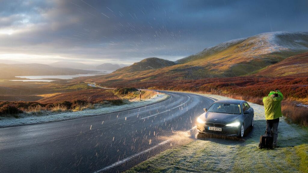
Short, lively showers can reduce visibility on high routes such as the A82 and A9, with a rapid switch from sunshine to spray or soft hail. Runners and hillwalkers should factor wind chill into kit choices; a lightweight shell and gloves make a big difference above 500 metres. Football and rugby fixtures go ahead, but pitches may turn slick where downpours hit.
Energy and household costs
A two‑to‑three‑night cool spell nudges up heating use, especially in off‑gas rural homes. Simple steps help keep bills steady: bleed radiators for efficiency, shut internal doors to trap warmth, and use timed boosts rather than leaving systems idling. A hot‑water cylinder jacket pays back quickly if yours still lacks one.
A quick guide to flurries, sleet and graupel
Flurries are light, intermittent snow showers that rarely settle on warm ground. Sleet is a mix of rain and wet snow that bounces on roads but melts on contact. Graupel, often called soft hail, looks like tiny polystyrene balls and forms when snowflakes pick up supercooled droplets in a shower cloud. All three can occur in the same hour when freezing levels hover near hilltop height.
What happens next week
Model spread grows as the month turns. A short settled spell remains possible as high pressure builds across parts of the UK, favouring chilly nights and local fog. Later, a return to Atlantic systems would bring wind and rain back to the north and west, while the south sees longer dry gaps. Temperatures trend close to average, with the brief weekend cold snap fading from memory—until the next northerly flick arrives.


Thanks for the heads-up. I’ll bump the heating timer, bring the tender plants in, and stick a scraper in the car just in case. Those 0c nights plus a northwesterly breeze can catch you out—felt colder than the thermometer last time!