A sharp 0°C line is sliding south across the UK, and the maps are suddenly a cold blue. Forecasters trace an Arctic air mass pressing down from the north, pushing overnight temperatures below freezing for millions. Gritters are out, windows are icing, and the morning routine just got slower. The question now is simple: how far does the freeze spread, and how fast?
I stepped outside before dawn and the world felt pin-drop quiet. The car looked sugar-dusted, breath hung in little clouds, and somewhere down the road a neighbour tested a reluctant engine. *It felt like the air had edges.* Back inside, phone in hand, I watched the latest temperature maps turn deeper and deeper shades of blue. North first. Then high ground. Then low. Wind arrows gathered like darts. The dog pawed at the door, unimpressed. Then the map turned blue.
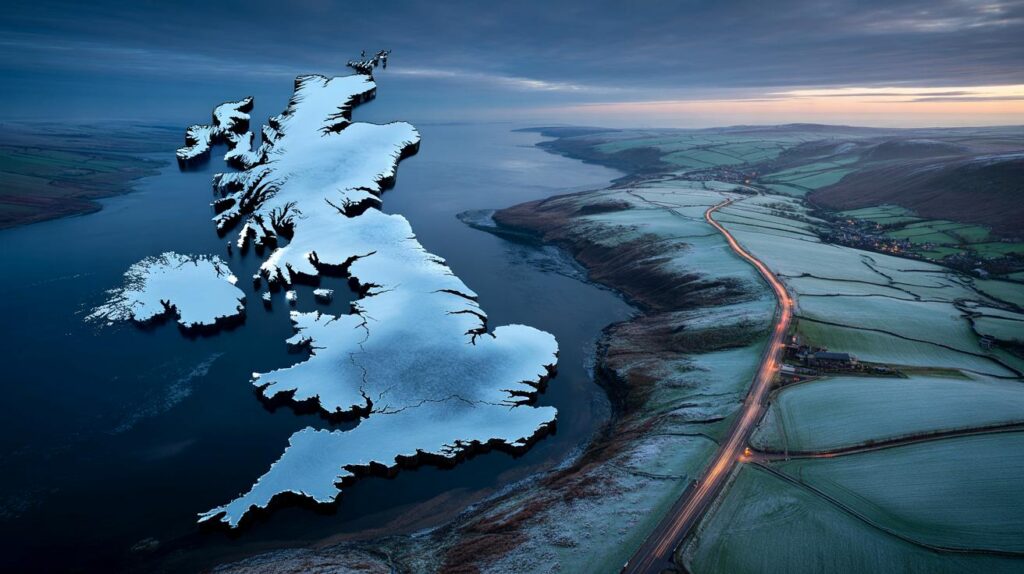
The blue tide on the weather maps
The freeze doesn’t arrive as drama; it seeps. Tonight’s charts show the **0°C** isotherm draped over Scotland by evening, then sliding through northern England after midnight, tracing city edges and river bends. A northerly fetch brings crisp, dry air, so skies clear and heat leaks upward. Wind chill nibbles at ears. It’s the kind of cold that sharpens sound and slows small talk.
By breakfast, pockets of -2C to -4C are likely in sheltered glens, with -1C common across the Pennines and into the Midlands. Road sensors flick from amber to red on exposed routes; the A9 and A66 become names you check before leaving. Coastal strips in the east flirt with sleety flurries as North Sea air brushes up against colder ground. In Cornwall and west Wales, milder sea air hangs on — for a moment.
Why now? A block to the west has nudged the jet stream south, letting **Arctic blast** air spill down the spine of the British Isles. Cold, dry, and dense, it undercuts the milder Atlantic flow, especially where skies stay clear after dusk. Urban heat islands keep inner-city lows a notch higher, but suburbs and valleys become frost bowls. Add a north-easterly breeze and the “feels-like” temperature drops another two or three degrees. That’s what the maps are really telling you.
How to cope right now
Start your morning ten minutes earlier and treat it like a ritual. Switch on the car, heaters to windscreen, fans low, air-con on to dry the air. Use a plastic scraper and a proper de-icer spray in smooth, confident strokes. Warm, not hot, water only if you must — and never boiling. Clear lights, mirrors, number plate. Tyres next: a quick glance for pressure and tread. You’ll leave calmer.
Indoors, think small, warm gains. Close curtains before dusk to trap heat and move furniture a palm’s width away from radiators. Draught excluders along floorboards are worth their weight in toast. A kettle refill saves your boiler cycling pointlessly. Layers beat one heavy jumper because trapped air warms you better. Let’s be honest: nobody does that every day. Tonight’s the night you’ll be glad you did.
On roads, it’s not heroics that help, it’s margin. Slower inputs, longer gaps, no harsh braking on glossy patches that look just a bit too clean.
“First frost is beautiful until it’s under your feet, under your wheels, and under your plans.”
- Carry: scraper, de-icer, torch, phone power bank, blanket, small shovel.
- Top-ups: screenwash rated to -10C, a half tank of fuel minimum.
- Footwork: boots with grip; trainers turn pavements into comedy.
- Mindset: if you’re tense, you’ll over-correct. Breathe and look far ahead.
It’s simple stuff, the kind that saves you once a winter and pays you back all season.
What the next few days could bring
The headline is simple: the cold deepens before it retreats. Model maps from the **Met Office** and independent chart sites keep that blue wash over much of the UK for several nights, with the risk of sharper frost where skies sparkle. Some eastern coasts may swipe at light snow grains, more mood than mayhem. Inland, it’s frozen puddles, crispy verges, and air that smells faintly metallic. We’ve all had that moment when the window glows white and you know the day will run slower. There’s a quiet, communal choreography to it — checking on older neighbours, swapping kettle tricks, texting the group chat about black ice at the top of the hill. The cold asks for little adjustments and offers those rare, clear mornings in return. Share the maps if you like. Share the lift if you can.
| Key points | Details | Interest for reader |
|---|---|---|
| 0°C freeze sweeping south | Arctic air mass drives sub-zero nights from Scotland into England and Wales | Know when and where frost will bite on your commute |
| Biggest risks on roads and pavements | Black ice on untreated routes, wind chill lowering “feels-like” temps | Practical steps to avoid slips, skids, and long delays |
| Smart prep wins | De-icing routine, home heat tweaks, car kit essentials | Save time, fuel, and stress while staying warm |
FAQ :
- How cold will it get?Many places dip to freezing or below overnight, with -2C to -4C in rural and high spots and slightly higher in city centres.
- Will it snow?Light flurries are possible along exposed eastern coasts; most inland areas see hard frost and the odd icy patch rather than settling snow.
- How long will the Arctic blast last?Several nights look frosty on current model runs, easing once cloud and milder Atlantic air edge back in from the west.
- Is it safe to drive at 0°C?Yes if you add margin: slower speeds, gentle steering, longer stopping distances, and winter-ready screenwash for clear vision.
- What’s the best way to defrost a car?Start the blower on the windscreen, use a scraper and de-icer, and avoid boiling water which can crack glass or refreeze as sheet ice.


Is 0°C really headline-worthy? Looks like a standard early-winter wobble.