The Met Office has issued a fresh three‑month winter outlook for the UK, flagging an elevated risk of sharp cold snaps, stormy bursts, and disruptive rain. Not a dramatic siren, more a clear nudge to get our houses and habits winter‑ready while there’s still time.
It started with breath blooming in the streetlights and a small crowd outside a corner shop arguing about thermostats. One man swore he wouldn’t touch the heating until December; another was already hunting for rock salt. On the bus ride home, I watched the weather app like it might blink first. Trains sighed past hedgerows, fields already slick with that dull November gleam, every puddle waiting to harden into a hazard. The Met Office update pinged my phone at 07:42 the next morning and felt both reassuring and unsettling. A calm note in an anxious season. The kind that makes you look up.
What the Met Office is really signalling
The headline is simple: a higher‑than‑usual chance of colder interludes, icy spells, and some punchy storms within the next three months. Think flip‑book weather — stretches of quiet, then a sharp northerly that bites your knuckles on the high street and turns untreated paths into marble. **This is not a snowmageddon headline; it’s a risk picture.** The outlook talks in probabilities, not promises, but the mood music is clear enough for anyone who’s ever queued for grit at 8am on a frosty Monday.
We remember how fast it turns. In 2018 the “Beast from the East” shut schools and stilled roads; in more recent winters, brief but brutal blasts sent temperatures plunging deep below freezing in parts of Scotland and iced the Midlands overnight. One week you’re rinsing mud off boots, the next you’re chiselling a windscreen and watching your street turn into a cautious ballet. That’s the kind of swing the outlook hints at: not a relentless deep freeze, but windows where Arctic air can spill in and make a regular workday feel like a small expedition.
What drives this? A jet stream that can kink and stall, high‑latitude blocking that parks chilly air over us, and the ever‑awkward dance between Atlantic lows and dry continental highs. Forecasters will be watching the polar vortex upstairs and the chance of a sudden stratospheric warming, which can flip the pattern and open the gate to cold. Sea‑surface temperatures and a tug from the tropics may add zest to storms, meaning rain can arrive heavy when it does arrive. In plainer English: bigger swings, punchier weather, and a higher risk of the kind of days that snarl commutes and test boilers.
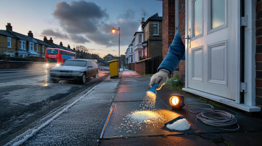
How to prepare without panic
Start with a 60‑minute winter check this week and forget heroics. Bleed radiators, set boiler flow temperature sensibly, clear the one gutter that always overflows, and put an ice scraper and head torch by the door. Order a small bag of grit before everyone else remembers, and charge a battery pack with the good cable taped to it. On your phone, update the rail and roads apps you actually use and add the Met Office warnings feed — not the noisy clones — so you get the alert before the scroll.
We’ve all had that moment when the first hard frost arrives and the de‑icer is mysteriously “somewhere in the shed.” The fix is small habits, not giant plans: draught stoppers at the worst gaps, curtains closed thirty minutes earlier, shoes moved to a mat that won’t turn into a puddle booby trap. Let’s be honest: nobody does that every day. Avoid the classic mistakes too — blocking vents with boxes, leaving gutters clogged until they pour onto steps, and relying on a last‑minute big shop when everyone else is reaching for the same loaf and batteries.
There’s comfort in a list you can actually finish before tea, so keep it brutally practical.
“Forecasts at this range are about risk, not certainties.”
Use that line as permission to prepare light and early, not heavy and late.
- Build a 15‑minute car kit: scraper, gloves, blanket, torch, spare phone lead.
- Set a Plan B commute: one bus route or walking route that avoids the glassy hill.
- Make a tiny check‑in routine: a WhatsApp to a neighbour on the iffy nights.
What it means — and what to watch
The smart read of the Met Office signal is this: tilt your plans, don’t twist your life. Keep an eye on the jet stream updates and the tone of long‑range notes, then pay close attention to the 3–5 day forecast where detail sharpens into decisions. **Small, early actions beat last‑minute scrambles.** Energy bills, school runs, delivery slots, match days — they all flow a bit smoother when you’ve nudged them a day or re‑timed a journey around the likely frost window. The winter we get may be fragmented and frustrating more than epic or endless. The trick is to move with it, not against it.
When the cold arrives, it won’t send an RSVP. Roads glaze between 6 and 8am, then melt into slush by lunch, then re‑freeze meaner at dusk. Storms can stack up after a pause, and that’s often when saturated ground tips into disruption. **The forecast is not fate.** It’s a set of loaded dice rolling over rail timetables, football fixtures, and quiet Sunday mornings. Prep light. Scan often. Borrow small calm from doing the obvious things early. Winter doesn’t ask for permission.
| Key points | Details | Interest for reader |
|---|---|---|
| Met Office three‑month signal | Higher chance of cold snaps, icy conditions, and stormy bursts across the season | Sets expectations and helps plan work, travel, and home routines |
| Drivers to watch | Jet stream shifts, high‑latitude blocking, possible polar vortex wobble, saturated ground | Explains why weather may flip fast and feel more intense when it changes |
| Do‑now actions | 1‑hour home check, car kit, updated apps, early grit, Plan B commute | Reduces stress, saves money, avoids last‑minute scrambles when warnings land |
FAQ :
- Is this a guarantee of a severe winter?No. It’s a probability‑based outlook indicating a higher risk of cold snaps and disruptive weather, not a fixed script.
- Will it snow where I live?Snow chances hinge on local elevation, wind direction, and timing. The 3–5 day forecast is where snow detail becomes meaningful.
- What should I do this week?Bleed radiators, clear key gutters, stock a small bag of grit, prep a simple car kit, and add the Met Office warnings feed to your phone.
- Could energy bills spike again?Bills track usage and tariffs, so colder spells can nudge them up. Efficiency tweaks and earlier planning help smooth the edges.
- What signs mean a colder spell is on the way?Watch for northerly or easterly winds in the short‑range forecast, high pressure over Scandinavia/Greenland, and falling overnight temps after clear days.


Clear and calm, not alarmist — thank you. The “risk, not certainties” line is exactly what I needed, plus the one‑hour checklist is actually doable. Ordering grit and updating apps tonight.
Every winter we get these outlooks and then it rains for weeks. Cold snaps, sure, but will it really bite this time? I’ll beleive it when the windscreen needs chiseling.