Grey skies gather again, and the forecast points to a soaking that could test drains, timetables and patience alike.
The Met Office has placed a yellow weather warning across swathes of southern England and Wales, running from midnight to 2pm on Wednesday. Forecasters flag a risk of flooding, slower journeys and possible power interruptions, and advise households to prepare a simple emergency kit that can be grabbed at short notice.
Where and when the weather will hit
The warning covers a 14-hour stretch when bands of rain are expected to push in overnight and intensify during the morning commute. Heavier bursts may move through in waves, leaving spray and standing water on key routes and reducing visibility for drivers. Bus and rail services could see delays or cancellations in the rush-hour window, with knock-on effects into lunchtime.
From midnight to 2pm Wednesday: 14 hours of persistent rain, 31 named areas on watch, with flooding and travel disruption possible.
WXCharts model output points to rain sweeping beyond the core warning zone at times, with the Midlands and the North West also seeing downpours. Not every location will experience the worst of it, yet the setup brings a clear chance of localised issues where showers repeatedly track over the same districts.
Areas named in the yellow warning
Large parts of the South West and Wales sit inside the warning, along with a slice of the South East. Towns and local authorities listed by forecasters include the following:
| Region | Local authorities and towns |
|---|---|
| London and South East England | Hampshire; Southampton; West Berkshire |
| South West England | Bath and North East Somerset; Bournemouth, Christchurch and Poole; Bristol; Cornwall; Devon; Dorset; Gloucestershire; North Somerset; Plymouth; Somerset; South Gloucestershire; Swindon; Torbay; Wiltshire |
| Wales | Blaenau Gwent; Bridgend; Caerphilly; Cardiff; Carmarthenshire; Merthyr Tydfil; Monmouthshire; Neath Port Talbot; Newport; Powys; Rhondda Cynon Taf; Swansea; Torfaen; Vale of Glamorgan |
What the yellow warning means for you
A yellow warning signals a risk of impacts rather than a certainty of severe conditions everywhere. Expect slower road journeys in wet spells, slippery surfaces, and occasional local flooding where drains struggle to cope. A small number of properties may take on water in the most exposed spots. There is also a chance of brief interruptions to power and other services if surface water affects infrastructure.
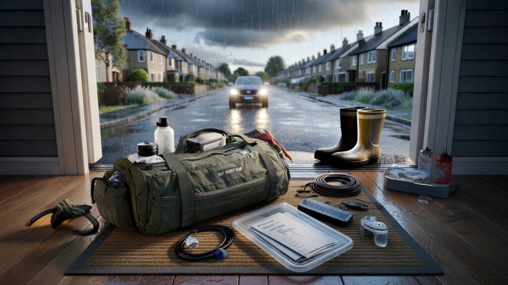
Grab bag guidance: food, water, first-aid basics, torches, phone chargers, key documents in a waterproof wallet, warm layers, and supplies for babies or pets.
Forecasters recommend checking whether your home sits in a flood-prone area and sketching out a simple plan. Agree who picks up the kit, who checks on neighbours, and where the family meets if you need to leave quickly.
How to pack a grab bag in 10 minutes
A small kit saves time when conditions turn. Use a rucksack you can lift easily. Keep it where everyone can reach it. Label it clearly.
- Water and snacks with good shelf life
- First-aid pouch and any prescription medicines
- Portable battery pack, charging cables, torch and spare batteries
- Copies of passports, insurance details and emergency contacts in a sealable plastic folder
- Cash, spare keys, lightweight rainwear and warm layers
- Baby items, pet food, leads and a foldable bowl if relevant
- Basic hygiene kit and hand sanitiser
Tell every member of the household where the bag lives. Run a quick drill so the routine feels familiar if you need to move fast.
Travel and commuting: plan b ready
- Check rail and bus timetables before leaving; allow extra time and expect short-notice changes.
- On the road, slow down, leave a bigger gap and use dipped headlights in heavy rain.
- Avoid driving through floodwater. Even shallow flows can hide potholes and stall engines.
- Watch for spray on dual carriageways, especially near HGVs. Keep your distance.
- If working flexibly, consider a later start to dodge the worst of the downpours.
Why the 14-hour window matters
Prolonged rain, even without extreme totals, can overwhelm drains when showers stack up. Overnight falls soften the ground. Morning bursts then run off more quickly, raising the chance of surface water on roads and pavements. With showers aligned along a slow-moving frontal zone, some neighbourhoods may catch repeated pulses while others see lighter spells.
Urban areas are particularly prone to fast-forming puddles because water has fewer places to soak away. Rural spots with saturated fields can see lanes flood as ditches fill. Rivers usually respond more slowly, yet small streams can rise quickly if several heavy bursts pass over the same catchment.
What the maps suggest beyond the core zone
WXCharts modelling shows multiple bands sweeping north-east across the country through the morning. The Midlands and the North West appear in the firing line for heavier bursts at times, even outside the named list. That aligns with a day where rainbands pivot and pulse, edging the risk into areas that may not sit under the formal warning for the full period.
After the rain: quick steps to protect your home
Move valuables and key electronics off the floor. Lift rugs and push furniture away from exterior doors. Clear leaves from gullies and yard drains if it is safe. Park on higher ground where possible. Charge phones and battery packs now, not when the lights flicker. Photograph important rooms and items for possible insurance discussions.
Never walk or drive through floodwater. Just 30 cm of fast-moving water can move a car, and much less can knock an adult off balance.
Check on neighbours who may need a hand, especially older residents or those with limited mobility. Bring pets indoors early and keep leads to hand in case you need to leave quickly.
Useful context for the days ahead
Yellow warnings sit at the lower end of the Met Office impact scale, with amber and red reserved for higher likelihood or greater severity. Impacts can still be sharp where showers align. Keep an eye on updates through the morning as the warning area and timing can shift when bands stall or speed up.
If your home sits near a stream or at the bottom of a slope, set a personal trigger for action, such as water lapping at the top of kerbs or repeated splashing over doorsteps. Practise a five-minute routine: lift valuables, switch off non-essential appliances, put flood strips at the door, grab the bag, and move the car to higher ground if it is safe.
Councils sometimes stock sandbags or alternatives, though supplies vary. Simple door barriers and coir rolls can divert shallow flows long enough to ride out a burst. For renters, photograph entry points and speak to your landlord about temporary flood strips and door brushes that reduce seepage during heavy showers.


Useful piece—thanks. The grab-bag checklist is spot on; I’d totally forgotten about copies of documents in a waterproof wallet. Charging power banks now and moving rugs off the floor just in case.