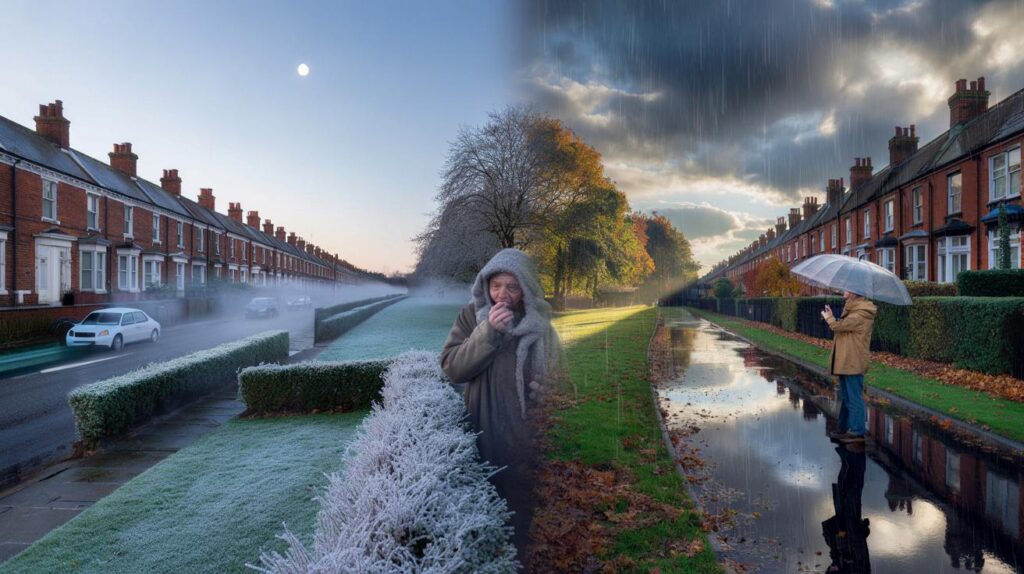
Frosted lawns, a clear moon, and breath in the air set the scene, as Britain steels itself for another twist.
After a nippy snap and a few flakes in the hills, forecasters now flag a quick rebound, with a milder push building from the southwest and a more unsettled pattern waiting in the wings.
From Arctic bite to Atlantic breeze
Cold Arctic air slipped south over the weekend, nudging temperatures down into low single figures and briefly to 0C in parts of the far north on Sunday night. Monday starts stayed crisp, with a notable chill lingering by day for many. That pattern does not last. Through midweek, readings recover to something closer to late-October norms, before a milder Atlantic flow edges in by Friday.
The Met Office expects a switch to a very mild feel by the weekend, following a steady midweek recovery.
Computer guidance shared by the Met Office shows the cold feed fading as a southwesterly takes hold. That draws in air that has crossed warmer Atlantic waters, lifting daytime highs and knocking back frost risk for most, at least temporarily.
What to expect day by day
- Monday–Tuesday: Chilly days, cold nights. Pockets of frost in the north and rural spots. Sunshine and showers.
- Wednesday: A notch up. Highs nudge into double digits for many, still coolest in the north and east.
- Thursday: Cloud thickens from the west. Patchy rain or drizzle reaches western hills later. Breezier near coasts.
- Friday 31 October: Milder southwesterly flow builds. Up to around 15C in the southeast; low teens more widely.
- Saturday 1 November: Similar highs of 14–15C possible in favoured southern areas. Breezy with showers in the west.
- Sunday: Widespread 10–13C. Bands of rain and blustery spells, with brighter gaps between fronts.
From 0C in the north on Sunday night to about 15C in the southeast by Friday: a swing you will notice.
Where the rain and wind will hit
Low pressure looks set to dominate into early November. That points to a changeable spell with frequent showers or longer periods of rain crossing most of the UK. Heavier bursts are most likely where Atlantic fronts first meet high ground in the west. Short breaks of brighter weather will appear between systems, though those clearer nights can still bring local fog and a touch of frost, especially inland.
Western areas are favoured for the largest rainfall totals, and there is a risk of gales at times.
| Region | Rain risk | Wind risk | Temperature trend |
|---|---|---|---|
| West (Wales, southwest England, western Scotland) | Frequent bands, some heavy on hills | Blustery, gales possible on coasts | Milder by day, fewer frosts |
| North and Highlands | Showers then longer spells of rain | Windy over high ground and shores | Cool nights, brief frost in clear spells |
| Midlands and east | Intermittent showers, drier gaps | Breezy at times | Near average, edging milder late week |
| South and southeast | Patches of rain late week | Often lighter winds at first | Up to 14–15C on Friday and Saturday |
Temperatures: back near the seasonal mark
After the early-week chill, the Met Office expects daytime highs to climb into the low to mid-teens for many places. Around 15C is possible in the southeast on Friday and again on Saturday, with 10–13C more typical elsewhere by Sunday. For early November, that sits close to, or a touch above, the long-term average for much of England and Wales. Nights trend less cold under cloud and wind, though any clear slot still carries a fog and frost risk inland.
Overall temperatures are likely to sit close to, or slightly above, the average into early November.
Your plans: what this means for you
Commuters can expect a colder feel through midweek mornings, then a milder turn by Friday. Runners and dog walkers will notice a damp, breezy pattern setting in, with decent windows for a dry outing in between showers. Gardeners get a short reprieve from frost later in the week, though saturated borders are likely in the west. Halloween events on Friday evening should feel comparatively mild, yet a light waterproof is a smart call where showers brush in.
- Layers work best: a warm start needed now, a lighter jacket by Friday and Saturday.
- Plan travel with margins: bands of rain, low cloud, and fog can slow roads and rail.
- Secure loose items outside: gusty spells could rattle fences and bins, especially near western coasts.
- Check gutters and drains: repeated showers and leaf fall increase the risk of localised surface water.
Why the flip is happening
The jet stream, the high-altitude river of air that steers our weather, has dipped to pull in a northerly over the weekend, then lifts enough to open the door to Atlantic systems. As low pressure tracks in from the ocean, winds turn southwesterly. That change of wind direction replaces the Arctic source with maritime air, raising temperatures quickly while also increasing the chance of rain and blustery interludes.
Beyond the weekend: a lively pattern
Into the first part of November, guidance points to a run of unsettled days, with showers and longer spells of rain sweeping the country. The most persistent wet weather favours western hills and coasts. Strong winds crop up at times, with gales in exposed places. Between systems, a few short, brighter windows offer decent daylight and a shot at fog formation after dusk if skies clear and winds drop.
Extra context and practical takeaways
Repeated showers on already damp catchments in the west can cause quick rises in small rivers and streams. Keep an eye on local updates where you live if you are in a spot prone to surface water. Drivers should anticipate spray and standing water, particularly on fast routes that cross upland corridors. Cyclists and motorcyclists face gust hazards on open bridges and coastal stretches.
The switch from cold to milder, wetter weather can also affect homes. Condensation increases when mild, humid air meets cooler interiors. Ventilate after showers and when cooking, and use extractor fans to reduce moisture build-up. Heating demand may dip with 14–15C daytime highs, yet breezy, damp conditions often make rooms feel cooler than the thermometer suggests, so a dehumidifier or short, early-evening heat boost can add comfort without excessive energy use.


Arctic bite to Atlantic breeze—so basically four seasons before lunch?
Met Offcie said “very mild” last time and I still scraped ice off the car. How confident are these models beyond midweek?