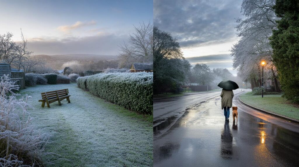
Leaves are falling, mornings feel sharper and the heating thermostat tempts a nudge. The season shifts, and with it, your plans.
Britain heads into the colder months with fresh guidance from the Met Office, sketching the likely shape of weather from October to December. The headline numbers point to a season that leans ordinary rather than extreme, yet regional quirks and short, sharp snaps could still test commutes, boilers and budgets.
What the probabilities say about your winter
There is a 55% chance of near-average temperatures, a 30% chance of mild conditions and a 15% chance of a cold season.
Forecasters assign the most weight to “near average” temperatures. That means many towns could sit close to long-term norms for daytime highs and overnight lows. A sizeable tilt towards mildness remains on the table, while a notably cold outcome carries the smallest share of the odds.
Precipitation looks near average at 70% odds. A wetter-than-normal three months looks less likely overall.
Rainfall signals vary by region. The north and northwest, especially uplands, carry a stronger chance of frequent fronts and persistent showers. Eastern and southern districts see a better shot at drier interludes.
Windiness sits near average with a 65% chance, 20% for a windier period and 15% for calmer conditions.
This points to a typical run of breezy days punctuated by a few gustier spells. A stormy season as a whole appears less favoured, though one or two deep lows could still barrel through.
Temperature: average to mild edges the field
Most homes can expect temperatures that track the long-term mean. That means frosts on some clear nights, misty starts, and cool, grey afternoons. A mild outcome would bring more cloud, fewer sharp frosts and greener lawns lingering into December. The colder scenario, while least likely, still matters for gritting plans, rail timetables and household heating bills in the event of a northerly burst.
What this feels like day to day
- Morning school runs: more damp chill than biting cold, with gloves useful on clearer mornings.
- Commuting: drizzle and low cloud more frequent than snow, but watch for patchy ice after radiative cooling at night.
- Energy use: demand likely tracks a typical year, with brief spikes during clearer, colder snaps.
Rainfall: a northwest–southeast split
Atlantic systems still favour the windward slopes of the north and northwest. Upslope enhancement can push totals higher in the Highlands, the Pennines and Snowdonia. Further east and south, rain shadows and weaker fronts improve the odds of longer dry windows. Gardeners may find soil workable between showers near the Thames Valley and East Anglia, while walkers in Cumbria should plan for frequent damp days.
| Region | Precipitation tilt | Notes |
|---|---|---|
| Scottish Highlands | Wetter | Frequent fronts; hill snow possible late in the period on colder days. |
| Northwest England | Wetter | Upland downpours at times; watch for saturated ground and localised runoff. |
| Wales (west and uplands) | Wetter | Persistent drizzle in onshore flow; limited sunshine between systems. |
| Midlands | Near average | Changeable spells; drier slots between fronts. |
| East and South of England | Drier | More dry days; fog risk on still, clear nights. |
| Northern Ireland | Near average to wetter west | Showery west; brighter breaks towards the east. |
Wind: typical breezes, a few punchy lows
The balance of evidence points to a familiar rhythm of fronts, brisk westerlies and calmer pauses. A modest chance of windier conditions remains, so coastal communities should still prepare for one or two squally episodes. With soils softening under autumn rain, even average gusts can topple shallow-rooted trees.
What could still tip the balance
The North Atlantic oscillation
Pressure patterns over the Atlantic steer our weather. A positive NAO often brings milder, wetter westerlies. A negative phase favours colder, drier northerlies or easterlies. Current guidance leans towards a mixed pattern, but short switches can flip conditions for one to two weeks at a time.
Stratospheric twists
Disruptions to the polar vortex high above the Arctic can unlock colder outbreaks in Europe a couple of weeks later. Signals remain uncertain this early. Keep an eye on updates as December nears.
Sea temperatures and moisture
Warmer-than-normal seas can feed extra moisture into passing fronts. That can boost rainfall totals on windward coasts even when seasonal means sit close to average.
What this means for travel, energy and planning
Rail and road operators should target drainage and leaf-fall mitigation now. Short-lived colder snaps can still ice rails and bridges after clear nights. Airlines and ferries will likely face standard autumn–winter disruptions on a handful of blustery days, rather than a long storm run.
For households, smart heating schedules make sense. Average to mild conditions reward small, consistent thermostat settings and good draught-proofing. Check guttering before the first proper deluge. Keep a torch and spare batteries ready for gusty days that threaten lines in rural spots.
Snow and frost risk
Lowland snow looks unlikely as a frequent visitor under the current balance of probabilities. That said, upland routes in Scotland, northern England and mid-Wales can see hill snow during colder intrusions, especially late November into December. Frost still bites on calm, clear nights, so gardeners should lift tender plants and insulate taps.
Week-by-week tactics you can use
- Check a daily five-day forecast every Sunday evening and Thursday morning to catch pattern flips.
- Batch indoor jobs for wetter weeks; book roof and gutter checks after two dry days for safe access.
- Stagger school uniform layers: base layer, fleece and showerproof top handle most morning ranges.
- Keep car tyres above 3 mm tread depth; fog and drizzle lengthen stopping distances.
- If you run a small business, review delivery buffers for the northwest routes most exposed to rain.
Key numbers to keep in mind
Temperatures: 55% near average, 30% mild, 15% cold. Rainfall: 70% near average. Wind: 65% near average, 20% windier, 15% calmer.
These figures sketch the broad canvas. Short spells can still buck the trend. A three-day cold shot can freeze roads, while a single vigorous Atlantic low can bring a month’s rain to a mountain catchment.
Extra context to deepen your understanding
Think of the seasonal outlook as a probability map, not a day-by-day diary. It informs risk planning: grit stocks, flood team readiness, staff rotas, and household maintenance. It does not fix the date of the first frost. You gain the most by pairing these odds with frequent short-range checks as fronts approach.
If you want a practical exercise, track your home’s daily gas or electricity use against outside temperature for two weeks. You will see how a one-degree drop prompts a measurable jump in consumption. That simple record helps you tune timers and loft insulation, saving money whether the season lands mild or colder than expected.


So 55% near‑average temps and 70% typical rain—does that mean fewer gritting days for counsils, or should budgets still assume a couple of short cold snaps?
Ah yes, Britain: 70% chance of drizzle, 30% chance of slightly different drizzle. I’ll keep my brolly and my optimism. 🙂