A north wind, a sudden dip to 0C, and rain sweeping south: weekend plans could look very different by Sunday.
Forecasters say the first flakes of the season could arrive over central Scotland this weekend, while swathes of northern England brace for a soaking. Early model runs point to a brief wintry window on higher ground before dawn on Sunday, with a widespread belt of rain pushing through later.
Where the first flakes may fall
Computer guidance based on MetDesk modelling, visualised by WX Charts, flags a narrow early-Sunday opportunity for snow over parts of the Central Belt and nearby uplands. Elevation matters: shower clouds tapping colder air will favour hills and passes first, with lower levels more likely to see sleet or cold rain.
Four counties sit in the firing line for the first autumn flakes: Stirlingshire, Clackmannanshire, West Lothian and parts of Perthshire.
These traditional counties span a swathe of central Scotland where modest height above sea level can tip the balance from rain to snow in a northerly. Towns at lower elevations may see nothing more than chilly rain and a brief wintry mix, while graupel or wet snow is most plausible over ridges, moors and the Ochil and Campsie Hills.
Temperatures could brush 0C in the small hours of Sunday, bringing a chance of rural frost and icy patches on untreated surfaces.
What forecasters are watching
- Timing: the coldest air arrives overnight into early Sunday, then gradually moderates during the day.
- Altitude: snow risk rises above roughly 250–350 metres, especially on windward slopes.
- Moisture: narrow bands of showers will make or break local snowfall; not all spots will catch a shower.
- Surface state: warm ground after recent mild days could limit settling except on grassy or elevated surfaces.
Rain for many, wind for some
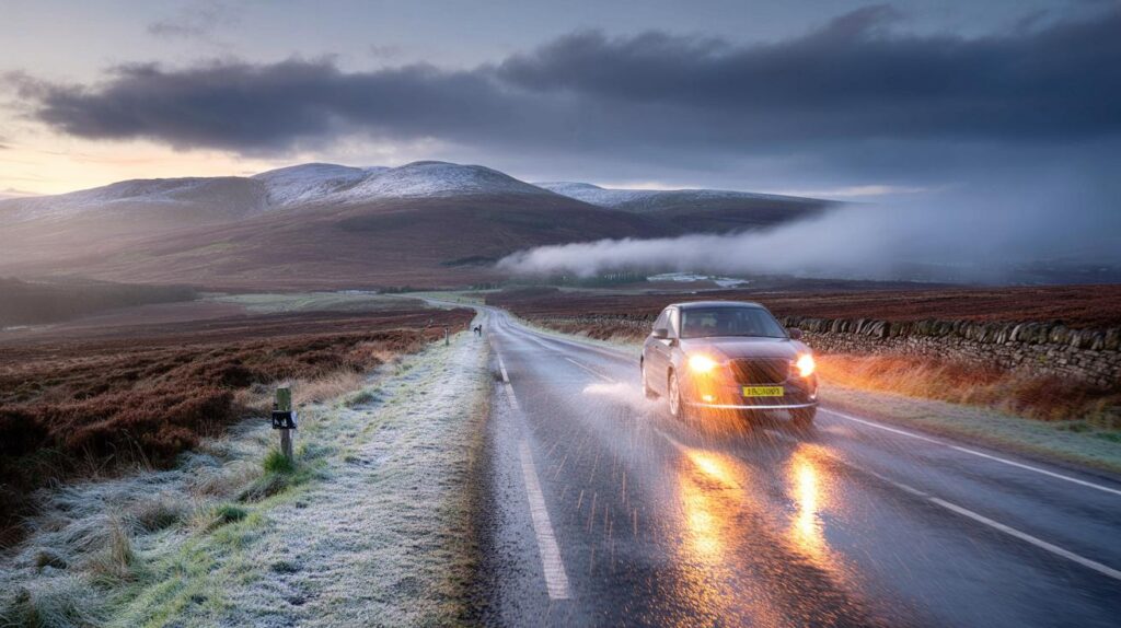
While Scotland toys with wintry showers, northern England looks wetter. Bands of rain are expected to swing south and east on Sunday as the northerly sets up, with the heaviest bursts over the Pennines and Cumbrian Fells. Stronger gusts may clip exposed coasts and high routes, reducing visibility in squally downpours.
Expect spray, surface water and slower journey times on key corridors. Urban drains may struggle during short, sharp bursts. Where showers align, local totals could mount quickly, even if the broader picture is showery rather than persistent.
| When | Region | Main hazard | Likely range |
|---|---|---|---|
| Sat night → Sun dawn | Central Scotland hills | Wintry showers, icy patches | Air 0–3C; wet-bulb near 0C above 300 m |
| Sunday morning | Northern England | Heavy rain, poor visibility | 10–25 mm widely; 20–40 mm uplands |
| Sunday daytime | Scotland north and west | Sunny spells, sharp showers | Hail/graupel risk in stronger cells |
| Sunday night | Rural north and northwest | Patchy fog, local frost | Ground frost where skies clear |
Why now: the setup behind the chill
A dip in the jet stream is encouraging a pocket of cool air to slide south from higher latitudes. With pressure lower to the east and higher to the west, a northerly feed locks in for a time. That pattern aligns with Met Office guidance for a northwest–southeast split: clearer, drier intervals most likely in the north and northwest, while the south and east sit closer to passing areas of low pressure and their showers.
As the coldest upper air brushes Scotland before dawn Sunday, showers over higher ground can turn wintry. Once the sun rises and air mixes, freezing levels lift and the snow risk fades, leaving a brisk, fresh day punctuated by showers near exposed coasts.
What it means for you
- Drivers in central Scotland: watch for slushy stretches on high routes at first light, especially through the Ochils and on moorland sections.
- Commuters in northern England: allow extra time on Sunday morning; downpours may reduce speeds on the M6, A1(M) and trans-Pennine routes.
- Walkers and runners: wind chill will bite on tops; pack layers, a waterproof, hat and gloves.
- Gardeners and residents: a light grass frost is possible in rural northwestern spots by Monday morning; protect tender plants and outside taps.
- Events and sport: be prepared for showers and gusty spells; pitch drainage and spectator shelter will matter.
The official outlook
The Met Office expects a fairly changeable start, with rain or showers most widespread across central, southern and eastern areas, occasionally windy. Into next week, the north and northwest hold the better chance of longer, drier spells, with a risk of patchy fog and rural frost where skies clear. A northerly flow brings a cooler feel for a time.
Later next week, high pressure could become a little more influential, bringing broader windows of dry, settled weather, although coastal showers may linger.
Temperatures trend closer to the seasonal average after the initial cool snap. BBC Weather guidance also points to a generally cooler phase as September progresses.
Peeking into early October
Forecast confidence drops as we turn the calendar page. Slow-moving patterns look the better bet, with high pressure near the UK at times, offering quieter spells. That setup can still allow nearby lows to nudge in, delivering rain to some areas on certain days. Temperatures will likely bob either side of average, rather than settling at a single theme.
Extra context you can use
What counts as the “first snow”
In the UK, the first autumn snow almost always appears over higher Scottish ground and often arrives as convective showers rather than a widespread, settling event. Even a brief spell of wet snow or graupel in shower clouds qualifies as the season’s first, though it rarely lies for long this early.
How forecasters judge early-season snow risk
Two numbers matter most: the freezing level and the wet‑bulb temperature. If the air near the surface is close to 0C when precipitation arrives, melting can cool the air further and tip cold rain to sleet or wet snow. A brisk northerly, steep lapse rates and lift over hills boost that chance. Lower towns, with warmer ground and slightly milder air, often just see cold rain.
Simple planning tips for the weekend
- Check route-specific forecasts if you’re crossing high ground around dawn on Sunday.
- Carry de‑icer and a scraper; windscreens may glaze in rural spots.
- Move flexible outdoor plans earlier on Saturday or later on Sunday to dodge the most active bands of showers.
- If you rely on trains or buses, allow for minor delays where heavy rain hits exposed lines.


Every September we hear “first snow”—will this actually settle anywher or just wet slush on the Ochils for 10 mins?
Thanks for naming the counties. As a commuter on the M9 near Stirling before dawn, should I expect gritters if temps brush 0C, or just cold rain?