A quiet spell after Storm Amy might not last. A sharper chill looms, and it could reshape your late‑October plans.
Forecast models hint at a swift turn from calm to wintry, with a brief but punchy cold snap targeting the weekend of 25–26 October.
What the latest maps suggest
Fresh model runs from WXCharts point to a drop in temperatures during Saturday 25 and Sunday 26 October. That cooling opens the door to snow showers, especially for higher ground and northern areas. The signal flickers rather than screams, yet it appears on multiple updates, which adds weight to the risk.
Model guidance shows a 36–48 hour window where snow showers could reach parts of Scotland, Wales and northern England.
On Saturday morning, the risk zone stretches from the Highlands and Grampians through the Southern Uplands, across north Wales and into the Pennines. By late afternoon and evening, the focus nudges south through England as colder air filters down behind a passing front, while Wales and Scotland retain the greatest chance of sticking flakes on hills.
On Sunday, the spotlight turns to eastern counties from Northumberland to East Anglia, with Scotland still favoured for further snow showers, particularly where northerly winds pile into coasts and uplands.
How cold could it get?
Daytime values sink several degrees from the current mild spell. Western Scotland could flirt with 0C at dawn. Many northern areas sit in the low single digits, with wind chill making it feel a notch colder. Southern England likely stays a little higher, but a sharper edge is still likely in the breeze.
Expect frosty starts in prone glens and upland valleys, and a notable wind chill on exposed routes.
The official outlook
The Met Office long‑range guidance flags a change to more unsettled conditions late in the month. Low pressure systems look set to regain control, bringing spells of rain and showers between brief, drier interludes. Temperatures tend to hover close to seasonal norms, which still allows short bursts of colder air if winds turn north or northwest for a time.
Before that shift, high pressure holds sway for much of 15–24 October. Many areas stay dry with variable cloud, brighter breaks and some overnight fog patches that may be slow to clear in places. Any rain or drizzle should be light and mostly confined to coasts and hills in the southeast and far north.
Who is most at risk and when?
Snow showers in October rely on fine margins. Altitude, wind direction and shower intensity matter. Here is a simplified snapshot based on current signals:
| Region | Sat AM | Sat PM | Sun | Lowest temps |
|---|---|---|---|---|
| Scottish Highlands & Grampians | Moderate risk on hills | Moderate risk on hills | Moderate to high on hills | 0 to 2C; sub‑zero on high tops |
| Southern Uplands & Borders | Low to moderate on hills | Low to moderate | Low to moderate | 1 to 4C |
| North Wales (Snowdonia) | Low to moderate on higher slopes | Low to moderate | Low | 2 to 5C |
| Northern England (Pennines, Moors) | Low on tops | Low to moderate drifting south | Low, mainly east | 2 to 6C |
| Eastern England (coasts and inland) | Very low | Low | Low to moderate for showers | 3 to 7C |
| Midlands, southern England | Very low | Low, brief flakes not ruled out | Very low | 5 to 9C |
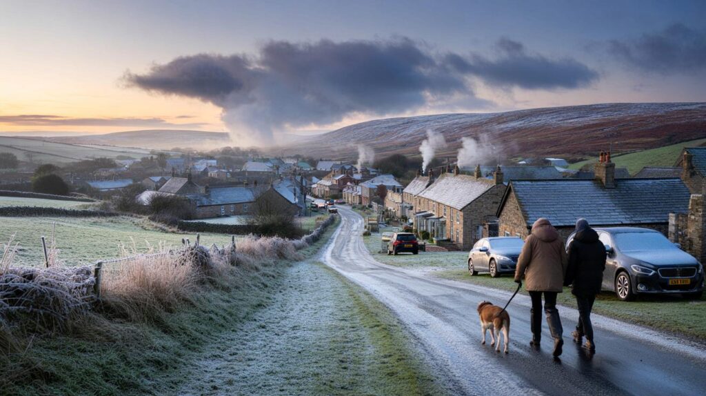
Travel and daily life: what it could mean
Short, sharp wintry bursts often catch people out because roads remain warm while air temperatures fall. That can lead to slushy surfaces that refreeze overnight on untreated stretches. Upland routes on the A9, A66 and across north Wales are most exposed to gusty winds and drifting showers.
- Check weekend events and travel plans if you’re heading north or into higher ground.
- Allow extra time at first light on Sunday if you live near east‑facing coasts.
- Pack layers and waterproofs; wind chill bites on open hills and stadium terraces.
- Cyclists and motorcyclists should prepare for wet‑to‑icy transitions where showers pass at dusk.
- Gardeners may want to lift tender pots or cover them before Saturday night.
Why this could happen after a mild stretch
High pressure has kept weather calm and relatively mild since Storm Amy cleared. As that high shuffles away, a lobe of lower pressure looks set to slide in from the northwest. That change flips the wind to a cooler quarter and taps a polar‑maritime air mass. Those air masses carry shower clouds that dump rain at low levels and, where air cools enough, snow on hills and sometimes to lower elevations in heavier bursts.
The uncertainty factor
Snow forecasts in October hinge on small shifts in wind direction and shower tracks. A 50‑mile wobble in the boundary between milder and colder air can move the snow line by several hundred metres. Keep an eye on updates if you live above 200–300 metres in Scotland, north Wales or northern England, or near North Sea coasts where showers can line up.
What to watch for as the weekend approaches
Signals that would strengthen the snow risk include a sharper northerly wind, clearer air arriving sooner on Saturday, and pressure falling over the North Sea which can funnel showers inland. If the wind turns more north‑westerly, western upslopes would take more of the showers, easing things in the east.
Health and home: small steps that help
Short cold snaps still impact health services. A quick overnight freeze can trigger slips on pavements and increase asthma flare‑ups as air dries. Consider checking on neighbours who feel the cold, and bleed radiators or set smart thermostats to avoid a Monday morning shock.
Context for this time of year
Snow in late October is unusual for low levels in England and Wales, but hills in Scotland and north Wales often see early season flurries when the first northerlies arrive. Ground temperatures are still relatively warm, so most low‑level snow would be short‑lived and slushy. High tops, especially above 600–800 metres, can cling on to a thin cover for longer if showers keep coming.
Looking beyond the weekend
Into the final days of October and the first week of November, a more mobile Atlantic pattern looks likely. That brings bands of rain, brisk winds and brief calmer windows. Temperatures tend to sit near the seasonal average, but short northerly bursts remain possible between systems, so further hill snow can’t be ruled out.
Extra detail for weather‑curious readers
If you track pressure charts, look for a ridge over the mid‑Atlantic and a trough over Scandinavia. A dip in the jet stream between them allows cold air to spill south towards the UK. The balance between those features decides whether we see a fleeting chill with a few showers, or a more organised spell with longer bands of wintry precipitation.
For hikers and fell‑runners, plan as if winter has started at altitude. Expect gusts over 40 mph on exposed ridges, rapidly changing visibility in showers, and ice on flagstones where meltwater refreezes. Carry microspikes if you’re heading above the snowline, and note that daylight is shrinking fast toward the clock change.


Is this likely to reach East Anglia on Sunday or will the sharper stuff stay on Scottish and Welsh hills? Debating a dawn drive, so timing definately matters!
WXCharts has cried wolf before—does the Met Office actually flag snow, or just “near seasonal” with brief northerly bursts? Reads a bit clicky unless hi‑res runs line up.