Dawn broke with bruised skies and whistling winds across the west, sending commuters hunting for waterproofs and patience.
By mid-morning on Sunday, a Met Office yellow warning for thunderstorms covers parts of south-west England and south Wales, with downpours, hail and frequent lightning expected to sweep north until midday.
Where and when the storms will hit
The focus sits over a strip stretching from Gloucestershire into Wiltshire, Somerset and the south-east of Wales. The warning came into force shortly after 8am and is set to expire at 12pm, but showers may linger locally after the headline period.
8am to midday: a fast-hitting window for torrential rain, hail and frequent lightning across the warning zone.
Areas under the warning
The core zone includes the following cities and their surrounding districts:
- Gloucester and parts of Gloucestershire
- Bath and parts of Somerset
- Salisbury and parts of Wiltshire
- Newport and nearby communities in south Wales
Neighbouring towns just beyond these centres may also catch intense showers as the band wobbles northwards, so short-notice changes remain possible.
What the Met Office expects
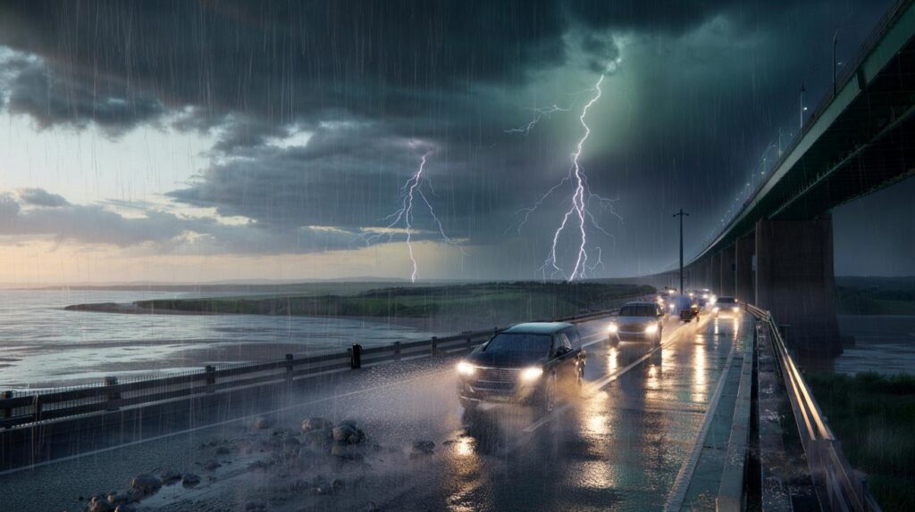
Forecasters say a band of heavy rain and thunderstorms will push north through the late morning. Some spots could clock 30–40mm of rain within a few hours, which is enough to swamp drains on busy routes and trigger brief surface water flooding in built-up areas.
30–40mm of rain in a short burst can flood low-lying roads, overwhelm drains and send spray across carriageways.
Frequent lightning and pockets of hail are likely near the most intense cells. Blustery winds will add to the mix, especially along western coasts where gusty conditions began before dawn.
Expected impacts at a glance
- Difficult driving conditions with spray, standing water and sudden visibility loss.
- A small chance of power cuts from lightning strikes or damaged lines.
- Localised flooding of roads and underpasses during the heaviest bursts.
- Possible disruption to trains and buses where water or debris affects the network.
- Short-lived hail showers, enough to rattle windows and slick pavements.
Travel and daily life: what to expect
Road networks across the warning area will feel the strain during the morning. Fast-falling rain can hide potholes and kerbs, while hail can briefly turn junctions slippery. On the railways, spray and leaf debris could cause temporary speed restrictions in places, particularly on exposed stretches.
| Hazard | Likely impact | Practical step |
|---|---|---|
| Intense rain | Surface water on key routes | Add time, reduce speed, use dipped headlights |
| Lightning | Isolated power interruptions | Charge phones, unplug non‑essential devices during nearby thunder |
| Hail | Slick pavements and minor vehicle damage | Park under cover where possible, watch footing |
| Gusty winds | Fallen twigs and small branches | Avoid parking beneath large trees; secure loose garden items |
Roads and rail
Drivers should expect sudden spray on dual carriageways and long braking distances. Pooled water often gathers near slip roads and roundabout exits. On rural routes, watch for debris after earlier coastal gales. Rail passengers may see short delays if heavy bursts coincide with peak services; check station boards before travelling.
Homes and businesses
Short, sharp downpours can push water back through blocked gullies. Clear leaves from doorstep drains if safe. Move delicate garden items indoors and fold parasols flat. Lightning can trip fuses without warning; keep a torch handy and protect sensitive electronics with surge protection.
Never shelter under an isolated tree during nearby lightning; seek a substantial building or a car with closed windows.
What the forecasters are seeing
Meteorologists report a blustery start across western counties, with coastal gales at times. Eastern areas began brighter, with hazy sunshine filtering through higher cloud. As the morning progresses, showers and thunderstorms bubble up in the west and push north, merging into heavier bands where cells align.
The atmosphere holds enough warmth and moisture for hail in the most vigorous updrafts. The contrast between breezier western coasts and calmer eastern counties explains the split between squally showers to the west and brighter intervals further east through the afternoon.
Why a yellow warning matters
A yellow warning signals an elevated risk of impacts for some people in the area, not a guarantee of disruption for everyone. It flags a need for awareness, particularly for those on the move or working outdoors. Short-range radar and satellite updates can nudge the most intense cells slightly east or west, so towns on the fringe should still plan for a heavy burst.
Eyes on the sky tonight: a ‘blood moon’ if clouds break
Once the storms run out of steam, attention turns skyward again. A total lunar eclipse is due on Sunday night, with parts of England and Wales in line for a view if skies clear. As the Earth slides between the Sun and the Moon, the lunar disc can glow deep red as sunlight refracts through our atmosphere.
Target around 7.30pm for the best chance of catching the eclipse if gaps open in the cloud.
This will be the first total lunar eclipse visible from the UK since 2022. Even a partial view through thin cloud can reveal that eerie copper tint. If showers persist early in the evening, larger breaks usually arrive from the west later, so patience could pay off.
Practical pointers before midday
Set off earlier for essential journeys and stick to main routes where possible. Keep footwear with grip and a compact umbrella, though avoid open areas if thunder is nearby. If you hear rumbles, lightning is close enough to be a risk; head indoors and wait 30 minutes after the final clap before resuming outdoor sport or DIY.
Businesses with shopfronts on sloping streets should check door thresholds and have absorbent mats ready. Delivery schedules may need a short buffer to account for heavy bursts. For those organising morning events, prepare a sheltered fallback and communicate any timing tweaks in advance.
Looking beyond today
Once the yellow window closes, showers will fragment in many areas, but wet patches can linger on saturated ground. The west stays breezy into the afternoon, while the east keeps longer bright spells. Keep an eye on updated forecasts if you plan to travel across the warning boundary, as short-notice extensions can occur when storms slow down.


Is Bristol on the fringe of this warning or safely outside? I’m on the M5 around 9am—should I definitley leave earlier?
Hail, lightning, gusts, then a blood moon tonite—did the weather subscribe to premium drama? Wild.