After weeks of seesaw skies, Britons are eyeing early September as models hint at a late burst of warmth.
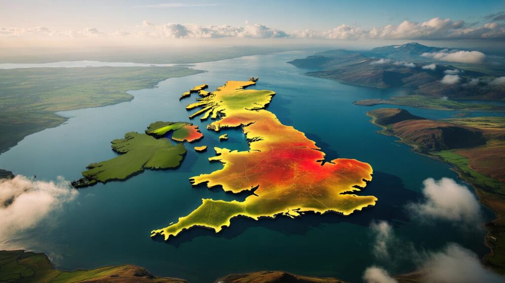
Computer charts are shading deep red again, with high pressure building from the Continent and pushing warmer, drier air across England. Forecasters point to a window around 8–9 September when parts of the east and south-east could brush 30C, while western coasts and Scotland stay cooler with onshore breezes and patchy showers.
When the heat is most likely to peak
Signals strengthen for a brief warm spell after the first week of September. The most consistent date range on several model runs sits between Monday 8 September and Tuesday 9 September. During this 36–48 hour stretch, drier air and sunshine could lift temperatures well above the seasonal norm for early September, particularly from East Anglia down through the Thames Valley and parts of the Home Counties.
Early signals point to 28–30C in the east and south-east on 8–9 September, with mid-20s spreading into the Midlands and north-west.
Before this uptick, the UK remains changeable. Low pressure to the west keeps showers and longer spells of rain in the mix through the first week, with some heavier bursts in western hills. As the jet stream kinks north, pressure edges higher over the near Continent, allowing warmer air to waft across the North Sea into eastern England.
Why temperatures may surge
A ridge of high pressure often acts like a lid, calming winds, breaking up cloud and boosting sunshine hours. With ground already warmed by an exceptional summer featuring multiple heatwaves, even modest sunshine can lift the mercury quickly. An easterly or south-easterly flow favours the east side of the country, which sits downwind of the Continent rather than the cool Atlantic.
Sea surface temperatures around the North Sea remain elevated, aiding mild nights. Daytime heating, plus light winds, could push urban centres a degree or two higher than surrounding countryside due to the urban heat island effect.
Expect the sharpest contrast between east and west: inland east warms fastest; Atlantic-facing coasts stay cooler in sea breezes.
Regional outlook: who stands to feel the heat
England’s east and south-east
Norfolk, Suffolk, Essex, Kent and Greater London look best placed for top temperatures. Clearer skies and a gentle easterly should nudge highs close to 30C in favoured spots. Nights turn muggy, with minimums in the mid to high teens.
Midlands and north
From Lincolnshire and Nottinghamshire up towards Yorkshire and into parts of Lancashire and Greater Manchester, high 20s are on the cards on the warmest day. East of high ground, a downslope breeze could add a degree locally.
Wales, south-west and western coasts
Closer to the Atlantic, cloud and showers linger longest. Most places cap out near 19–22C, though sheltered valleys could briefly touch 23–24C.
Scotland and Northern Ireland
Scotland warms more on Tuesday 9 September as air stabilises, with the central belt reaching the low 20s. The Highlands and islands stay cooler, often mid to high teens. Northern Ireland follows a similar pattern with brighter breaks boosting temperatures into the high teens or low 20s.
| Location | Mon 8 Sept (°C) | Tue 9 Sept (°C) | Notes |
|---|---|---|---|
| London | 29–30 | 28–29 | Very warm, light easterly, muggy nights |
| Norwich | 28–30 | 27–29 | Sunny spells, cooler near the coast |
| Hull | 26–28 | 26–27 | Warmest east of the Pennines |
| Manchester | 23–25 | 24–26 | Warmer Tuesday with brighter breaks |
| Cardiff | 19–21 | 20–22 | Sea breezes, risk of a shower |
| Glasgow | 17–19 | 19–21 | Turning warmer Tuesday |
What the Met Office guidance signals
For 3–12 September, official guidance keeps a changeable theme in play, with showers or longer spells of rain popping up at times, especially in western areas. There is still space for brighter, calmer interludes later in the period, and those drier windows offer the best chance of temperatures nudging above the seasonal average. Any plume of warmer air from the near Continent during such a window could tip the east and south-east up to around 30C.
Short settled spells later in the second week look warm for the time of year, bookended by more typical showery weather.
Will this count as an ‘Indian summer’?
In British usage, people apply the phrase to a warm, settled spell in early autumn following an earlier cool snap. While meteorologists prefer precise terms, a 28–30C burst after a wetter, cooler first week of September would match what many consider an Indian summer feel—brief, sunny and warmer than average, without the prolonged intensity of mid-summer heatwaves.
What could derail the warm-up
Forecast confidence is moderate rather than high. Small shifts in the position of the high can flip the outcome from sunny and warm to cloudy with cool onshore breezes in the east. A deeper Atlantic low edging closer would freshen winds and pull in cooler air. Thunderstorms also sit on the table if a tongue of humidity rides north and collides with cooler air aloft.
- If the high centres over Germany, eastern England benefits most.
- If the ridge stalls farther south, cloud off the North Sea trims highs by 2–4C.
- If Atlantic lows deepen, western showers turn heavier and more frequent.
Practical tips if the heat arrives
Late-season warmth can catch people out. Pavements and vehicles heat quickly, and indoor spaces may lag, holding heat overnight. Sensitive groups—older people, those with heart or lung conditions, and very young children—feel the strain first during warm, humid nights.
- Plan outdoor work or runs for early morning or evening; shade the south-facing side of your home by midday.
- Carry water on commutes; check rail updates as heat can affect track conditions and speed restrictions.
- For coastal trips, expect cooler conditions and brisk sea breezes; pack an extra layer even if inland is hot.
Additional context you can use
What “above average” means in early September
The long-term daytime average for early September sits near 19–21C in southern England and 16–18C in the north. Hitting 28–30C places readings 7–10C above that baseline, similar to a typical July afternoon rather than an autumn one.
Thunderstorm risk and where it sits
Warmth arriving over damp ground can prime the atmosphere. If a weak front noses in from the west during the warm spell, the boundary zone from the Pennines into southern Scotland could spark heavy showers with hail and thunder. Lightning risk peaks late afternoon and early evening when daytime heating tops out.
What happens after 9 September
Signals lean back towards a more mixed pattern, with the ridge easing and showers pushing in from the west again. That does not rule out further short, warm interludes later in the month, but the most reliable window for a late-summer feel currently sits around 8–9 September.
Keep plans flexible: a shift of 100–150 miles in the pressure pattern is enough to move the warmest air away from your area.


If the east really nudges 30C, I’m definately dusting off the BBQ. Appreciated the city-by-city table and the note on urban heat island—explains why my flat in London feels like a furnace by 10pm.