A softer winter may be brewing, yet crisp mornings, patchy fog and the odd sharp snap could still catch you out.
As autumn beds in, the latest long‑range guidance points to a less severe season than recent years. The signal favours near‑average to mild conditions, but the spread across the country looks uneven. Here is how cold it could feel where you live, what might fall from the sky, and how to prepare your home and routine.
What the Met Office is signalling
The current three‑month outlook suggests a bias away from deep cold. Forecasters lean towards temperatures near the seasonal norm, with a tilt towards milder spells driven by higher pressure at times. That setup often brings drier weather for many, lighter winds and some stubborn fog and frost in places.
Headline signal: about a 55% chance of around‑average temperatures and a 30% chance of milder‑than‑average conditions through late 2025.
Rumours of imminent snow for Scotland and northern England have been knocked back. The late‑October signal does not support widespread early snow. High pressure nearby limits the conveyor belt of Atlantic storms, but it can trap damp air and produce chilly, grey days that feel raw even when the thermometer looks tame. Rain remains possible in exposed western and northern fringes when fronts brush the edges of the high.
Regional steer: southern England trending near 8°C in the coming weeks, while colder inland parts of Scotland can dip close to 1°C on average.
Monthly temperature guide so far
Indicative UK averages for the lead‑in to winter show the seasonal slide. Local conditions vary widely — uplands and frost hollows run colder, coasts often stay a touch milder.
| Month | Typical UK average (°C) |
|---|---|
| October | 9.73 |
| November | 6.48 |
| December | 4.20 |
Regional split: what that means where you live
Winter rarely treats every corner of the UK the same. The coming pattern continues that theme.
- South and Midlands: more dry spells under high pressure, average days near mid‑single digits by December, chilly nights with frost and fog risk.
- North of England: cooler overall, with brief incursions of rain or sleet on northern hills when Atlantic fronts graze the region.
- Scotland: sharpest chill inland and in glens; coastal areas often stay a little milder but windier. Occasional wintry showers over higher ground later in the season remain possible.
- Wales and south‑west: breaks of sunshine between fronts; when the high weakens, rain targets the west first.
- Northern Ireland: mixed; drier under blocking highs, wetter and breezier when the Atlantic reasserts itself.
Why a milder signal does not rule out snow
A “mild‑leaning” winter can still deliver short, sharp cold snaps. The North Atlantic Oscillation (NAO) steers our weather: a positive phase favours milder westerlies; a negative phase opens the door to polar air. Sudden stratospheric warming, if it develops later, can also flip the pattern and drag cold south for a week or more.
No widespread early‑season snow signal appears in late‑October guidance, but brief cold spells later cannot be discounted.
If a chilly interlude arrives, the first places to turn wintry are usually Scottish mountains, the Pennines and higher parts of Wales. Lowland snow needs colder air, lighter winds and a supply of moisture at the right moment. Even then, many events settle briefly overnight and turn slushy on roads by late morning.
How this winter could feel day to day
High pressure can create a deceptive chill. Sunshine feels pleasant at midday, yet clear nights allow heat to escape. That pattern brings hard frosts, icy pavements and patchy freezing fog, especially in valleys. In cities, temperatures linger a degree or two higher, but damp corners can stay icy through the school run.
When the blocking weakens and the Atlantic pushes in, expect milder, breezier interludes and a few days of rain spreading from the west. These spells lift temperatures, reduce frost risk and raise river levels. Commuters in exposed areas should plan for crosswinds on bridges and wet‑surface braking distances.
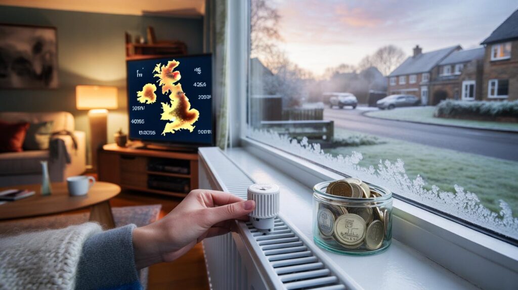
Bills, heating and your home
A less severe winter often reduces peak demand for heating, but the daily picture still bites. The biggest costs usually build during cold snaps and during long, dull stretches where the air stays damp and chilly.
- Use a timer so heating runs when you need it, not constantly; steady schedules help some homes feel warmer for less.
- Target an indoor setpoint around 18–20°C for occupied rooms if healthy; turn down radiators in rarely used spaces.
- Bleed radiators, check boiler pressure and book a service before the first long cold spell.
- Seal draughts around doors and letterboxes; a simple brush seal can cut heat loss and reduce cold spots.
- Watch indoor humidity with a small hygrometer; aim for 40–60% to curb condensation and mould risk.
Practical tip: lowering the thermostat by 1°C can cut gas use in many homes while staying comfortable with layers.
Travel, schools and outdoor plans
Dry weather reduces disruption, but cold, still nights raise the risk of black ice on untreated routes and car parks. Keep de‑icer and an ice scraper in the car. Cyclists should expect slick patches at dawn near grass verges and shaded pavements. Schools may see more fog‑related delays than snow closures if the high holds through early winter.
What to watch as we enter January and February
Confidence drops as we look beyond December, yet a few markers help you read the road ahead.
- North Atlantic Oscillation: a turn to negative often brings a colder, drier pattern with frost and a greater chance of snow showers in the north and east.
- Stratospheric signals: any sudden warming event can disrupt the polar vortex and send Arctic air south 10–14 days later.
- Sea‑surface temperatures: lingering warmth near the British Isles can feed moisture into arriving fronts, increasing rain in mild spells.
- Ground state: repeated frosts harden surfaces, so even light precipitation can glaze pavements and minor roads.
Cold‑snap checklist for households
- Protect pipes in lofts and unheated spaces with lagging; fix dripping taps that can freeze and split.
- Move salt or grit to the front of the house; treat steps the evening before a frost.
- Prepare a two‑day larder of ambient staples in case fog or ice slows deliveries.
- If you support an older neighbour, plan a quick warmth check on the first sub‑zero night.
Extra context to widen your view
Two “mild‑leaning” winters can feel completely different. One is breezy and damp, with few frosts. Another is mainly calm and dry, with repeated frosts and freezing fog. The latter often feels colder indoors because still, humid air and clear nights sap heat from buildings. That’s why small actions – stopping draughts, drying laundry earlier in the day, ventilating bathrooms after showers – change comfort levels more than the headline temperature might suggest.
You can also track how your home behaves with simple numbers. Note the outdoor high and low each day and the hours your heating runs. If a 5°C day forces much longer boiler time than a 7°C day, you’ve found a threshold where curtains, door snakes and radiator balancing pay off. That personal “degree‑day” view helps you decide when to set the timer earlier or add a throw on the sofa.
Bottom line for winter 2025/2026: odds favour a gentler season, yet brief cold spells, frosts and pockets of wintry weather remain on the table.


Genuinely curious: if southern England hovers around 8°C and parts of Scotland near 1°C, how much could the average bill actually drop in practice? Tariffs and standing charges haven’t exactly fallen off a cliff. Are we basically relying on fewer boiler hours, or do suppliers factor in seasonal demand at all? Any data on kWh usage vs tempreatures would be super helpful.