After a restless season of glare and downpours, the atmosphere flips again, demanding quick choices about shorts, coats and plans.
Parts of England are on course for a brief, late-summer lift into the mid‑20s before a sharp swing to chilly nights returns. Forecasters expect a warm plume to peak on Wednesday 3 September, then fade as low pressure drags in rain, brisk winds and a nippy edge.
Where the warmth lands
Latest weather maps point to a swathe of eastern and south‑eastern counties reaching 23C to 25C at midweek. Coastal stretches should feel balmy for a spell. Inland towns may edge a fraction higher in sunny breaks.
Temperatures of 24C to 25C are most likely on Wednesday across East Anglia, parts of the South East and the Home Counties.
Areas favoured for the warmest air include the following:
- Norfolk and Suffolk, with warmer coasts and sheltered inland spots
- Cambridgeshire and Lincolnshire, bright where cloud thins
- Kent and Greater London, locally hot in the afternoon commute
- Surrey, Berkshire and Hertfordshire, warmest in urban corridors
- Buckinghamshire and Bedfordshire, mild evenings after sunny spells
- Northamptonshire and Leicestershire, patchy cloud but pleasant highs
- Rutland and Nottinghamshire, warmest mid‑afternoon
- East Riding of Yorkshire, brief spikes under sunny gaps
The north and west turn cooler and more changeable. Wales, Scotland and Northern Ireland see lower daytime values and more showers. Western coasts catch heavier bursts when fronts cross.
How long it lasts
The warm pulse looks short. By late week, fresher Atlantic air under low pressure pushes across the country. Showers become widespread. Longer spells of rain sweep in at times, especially in the west.
Nights could dip to around 3C in rural pockets after the warm spell fades, signalling an early autumn chill.
Thunder and hail are possible in the livelier showers. Gusty winds may accompany deeper lows tracking near the British Isles. Brief settled windows can still pop up early and late in the period, but they likely won’t linger.
This extraordinary summer in numbers
After four heatwaves, hosepipe rules and parched ground in places, 2025’s summer has pushed the record books. Provisional Met Office data up to 28 August places the seasonal mean at 16.13C, which would make it the warmest on record if confirmed. Previous leaders included 2018 (15.76C), 2006 (15.75C), 2003 (15.74C), 2022 (15.71C) and 1976 (15.70C).
Four distinct heatwaves hit the UK this summer, with thresholds exceeded repeatedly in the south and east.
The warm midweek burst is best seen as an aftershock of that remarkable season. The atmosphere still holds residual warmth, but the broader pattern is pivoting toward autumn dynamics.
Why the north and west miss out
The jet stream is sliding south and strengthening. Systems roll in from the Atlantic more often. Scotland, Northern Ireland and Wales sit closer to the storm track. Cooler marine air under cloud caps daytime values. Windward slopes also wring out more rain.
Eastern England lies in the lee of that flow at times, where dry slots and sunshine punch temperatures higher. Once the frontal train arrives, the east also turns unsettled and fresher.
Regional snapshot at a glance
| Region | Midweek daytime high | Late‑week night low | Headline conditions |
|---|---|---|---|
| East Anglia | 24–25C | 5–7C | Sunny spells, warm; turning showery later |
| South East and London | 23–25C | 6–8C | Warm, humid at times; breezier with showers late week |
| Midlands | 22–24C | 4–6C | Bright intervals; outbreaks of rain developing |
| North East and Yorkshire | 21–23C | 4–6C | Warmest in sunnier slots; cloudier later |
| North West and Wales | 17–20C | 3–6C | Showers, heavier near coasts; breezy |
| Scotland and Northern Ireland | 15–19C | 3–6C | Changeable, some heavy downpours and hill fog |
What this means for your week
Plan outdoor time for Wednesday afternoon if you are in the east or South East. Shade and water matter during warm commutes. Roads may soften in strong sun, so expect localised slowdowns on busy routes.
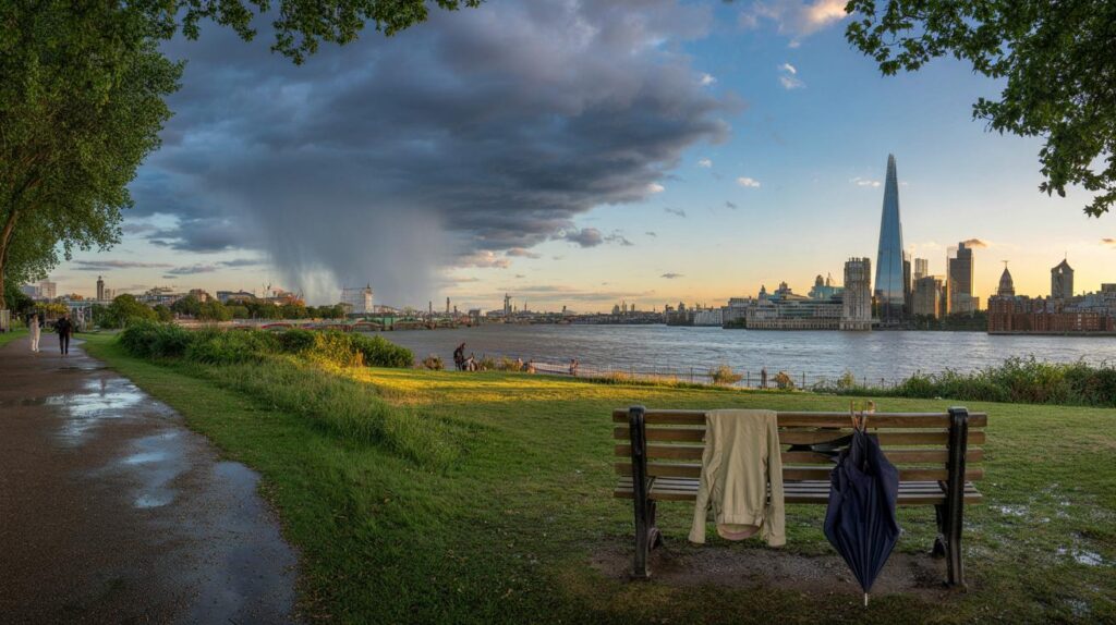
Pack layers for late week. A light jacket helps when showers pass. Keep an umbrella handy for pop‑up downpours. Gardeners should check local hosepipe guidance after the dry spells; recent rain will not refill reservoirs overnight.
Warm midweek, then a pacey flip to showers, brisk winds and chilly nights. Keep plans flexible.
Runners and outdoor workers should time efforts for the cooler morning or early evening while the warm air holds. Later in the week, watch slippery pavements under heavy showers and fallen leaves.
Key timings to watch
- Wednesday 3 September: peak warmth in East Anglia, the South East and Home Counties.
- Thursday: warmth fading from the west; showers expanding, winds freshening.
- Friday into the weekend: widespread showers or longer rain spells; isolated thunder and hail possible.
- Early next week: short drier interludes may return for a time before further fronts arrive.
Context that helps the forecast make sense
Heatwave thresholds vary by county, reflecting local climate. Many southern and eastern areas hit those thresholds multiple times this summer. That frequency strains soils and river flows, even when showers look frequent later.
“Feels like” temperatures can run higher than the air temperature during humid spells, especially in towns. Pavements and buildings store heat. That raises overnight minima locally. By contrast, rural clear slots at the end of the week will cool quickly under calm skies, which nudges thermometer readings near 3C in frost‑prone dips.
Practical extras for households
Check gutters and drains before the unsettled spell. Sudden downpours on dry ground can overwhelm blocked grates. Secure garden furniture ahead of gusty bursts. Air the house during the warm midweek window, then close windows during showery, windy spells to keep draughts down.
If you manage events or sports fixtures, set heat guidance for Wednesday and wet‑weather contingencies for Friday and the weekend. For rail users, heat can affect overhead lines briefly, then heavy rain can slow services, so keep an eye on operator updates on the day.


We were promised “warm bursts” all summer and got downpours. Why should this be any diferent?
Thanks for the heads‑up — planning a BBQ in Hertfordshire on Wednesdy, then packing the raincoat for Friday. Any update on thunder risk for the Home Counties late week?