After a sweltering summer, September brings a new rhythm. Plans shift, jackets return, and the talk turns to rain chances.
Many of you are asking whether the sun has one last burst to give. Hopes of a late 30C surge linger, yet the broader set-up points to a cooler, changeable spell rather than a fifth heatwave.
No fifth heatwave on the cards
The UK chalked up four heatwaves this summer, putting 2025 among the hotter seasons on record. That track record fuels chatter of an ‘Indian Summer’. Forecast guidance, including signals from the Met Office, suggests something more restrained. Daytime highs generally sit in the low 20s Celsius for England and Wales, high teens further north and west. That’s typical for early to mid-September, not heatwave territory.
Most places hover close to, or a touch below, seasonal norms, with only short, warmer interludes before fresh Atlantic air returns.
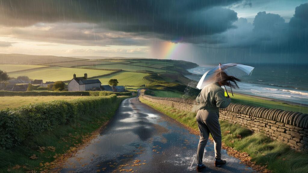
From around 4 to 13 September, a lively Atlantic pattern brings spells of rain, scattered thunderstorms and gustier winds, especially across western hills and coasts. The southeast holds the best chance of brighter breaks, but even here showers can pop up between sunny intervals.
What the first half of September looks like
Temperatures you can plan around
- England and Wales: 19–23C by day, 11–15C by night; brief 24–25C possible before fronts arrive.
- Midlands and northern England: 17–21C; cooler nights in rural spots.
- Scotland and Northern Ireland: 14–19C; fresher under persistent cloud and showers.
- Warmth feels humid at times ahead of rain bands, then fresher air follows with clearer skies.
Rain, thunder and wind: where and when
The most unsettled windows favour the west as low-pressure systems cross from the Atlantic. Bands of rain sweep east, breaking up into showers with sunny gaps. Embedded downpours may produce small hail and a few rumbles of thunder. Short-lived squally gusts could catch exposed locations during heavier bursts.
4–13 September: mixed skies nationwide, with heavier rain and thunder most likely in western counties and along windward coasts.
Ground already dry after summer heat can shed water quickly, so urban runoff becomes an issue under intense showers. Localised surface flooding is possible on saturated stretches, especially where drains clog with early leaf fall.
Why it turns changeable now
The jet stream tends to drop south in early autumn, steering a chain of Atlantic lows toward the British Isles. Sea surface temperatures around the UK remain warm after summer, adding energy and moisture to passing systems. The result is classic September variability: a warm, humid day with showers, then a cooler, clearer day behind a front.
Hints of a brief ridge can still appear between lows. That brings a window of calmer, warmer weather for a day or two, most often across the south and east. These breaks look short-lived before the next frontal system arrives.
Your week, sorted
Commute and school run
- Carry a compact umbrella and a lightweight waterproof. Showers form quickly and fade just as fast.
- Expect gusty crosswinds on exposed bridges and coast roads during heavier pulses of rain.
- Leave extra minutes for standing water and spray; braking distances increase sharply after dry spells.
Events and outdoor plans
- Schedule early starts for outdoor tasks. The most frequent showers often follow daytime heating.
- Pick venues with shelter options. A gazebo or tree line makes a difference in sudden downpours.
- For sport, check the latest radar on the morning. A 30-minute shift can dodge a shower train.
Garden, home and health
- Use the showery pattern to water newly planted beds; top up only after a dry 24 hours.
- Clear leaves from gullies now. Early blockages turn a short burst into a doorstep puddle.
- Asthma and migraine sufferers: carry medication. Pressure jumps and damp air can trigger symptoms.
Key dates at a glance
| Dates | Headline | What to watch |
|---|---|---|
| 1–3 Sept | Bright spells, a few showers | Cooler nights under clear slots |
| 4–9 Sept | Rain bands cross, blustery in the west | Heavier bursts with thunder risk |
| 10–13 Sept | Showery, sunny gaps, fresher feel | Short, warmer interludes in the south |
No widespread, prolonged heatwave is signalled; instead, brief warmth pops up between changeable spells.
What “Indian Summer” really means
The phrase often gets attached to any warm spell after August. Traditionally, it describes a settled, warmer run of weather after the first autumnal chill, usually under a blocking high. What’s ahead looks different: short calm windows between mobile lows. That doesn’t rule out a pleasant afternoon at 23–25C in the south, but it falls short of a named heatwave with several days above threshold values.
How to read a September forecast
Short range vs. medium range
- 0–48 hours: high confidence. Track timing of fronts and thunder risk.
- 3–7 days: moderate confidence. Expect changes in where rain bands set up.
- 8–14 days: pattern confidence only. Plan for variability, not specifics.
Use hourly forecasts for the school run or a match day, then check again two hours before you leave. Shower lines often split or stall on hills and coastlines, so local detail matters on the day.
Extra context that helps your plans
Shower versus longer spells: a shower is a short, often intense burst under a convective cloud. It can dump 5–10 mm in 30 minutes, then the sun returns. A longer spell is tied to a front, lasting one to three hours but sometimes lighter. Thunder usually favours the time window just ahead of a front when humid air rises fastest.
Travel example: if you’re driving west from London to Cardiff between 4 and 9 September, leave flexibility. A dry start in the east can turn into low cloud, drizzle over the Brecon Beacons, then heavy bursts near coastal stretches. Build a 20-minute buffer and check river and flood alerts if you cross low-lying routes.
There’s a silver lining for energy bills. Fresher nights allow windows open for cooling rather than switching fans back on. Showery top-ups help lawns revive after summer stress, reducing hose use. Cyclists and runners gain clear, crisp mornings after a front passes, often with excellent visibility.
Risk-wise, the main hazards are short-lived but impactful: slick roads after long dry spells, ponding on underpasses, and lightning in a few storms. If thunder arrives, pause outdoor play, avoid tall isolated trees, and wait 30 minutes after the last rumble before resuming activities.


So basically: brolly in the morning, suncream at lunch, windbreaker by tea time? Classic UK moodboard 😅 Thanks for the heads-up!